Are you headed to Santorini, Greece? It’s known for breathtaking views, blue dome churches, and whitewashed Cycladic homes hanging cliffside over the Aegean Sea–but there are hidden gems everywhere. Come along as we get off the beaten path!
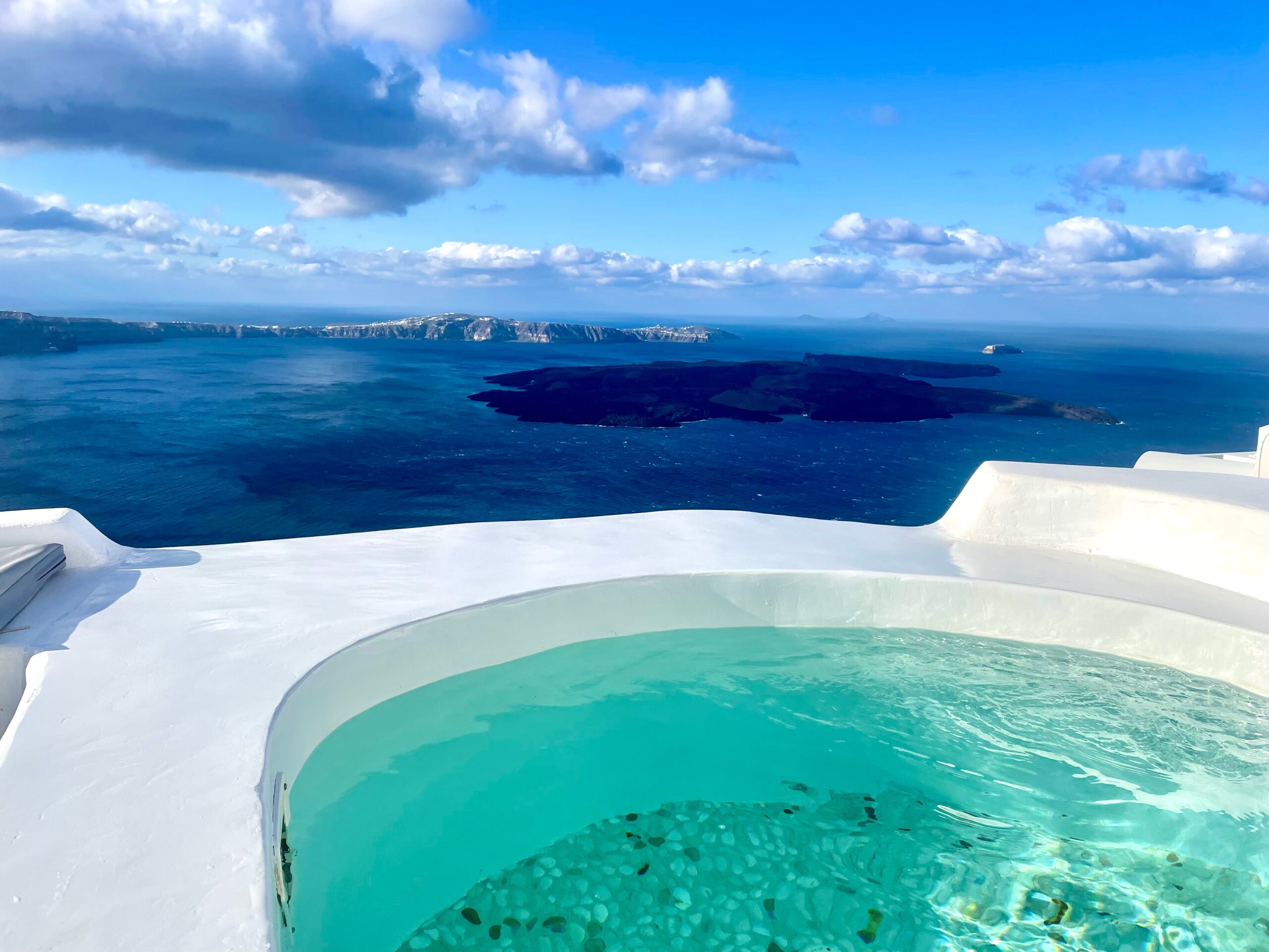
View from our airbnb hydrotherapy pool.
We’ll go south of Fira to explore lesser-known villages, archaeology sites, beaches, the lighthouse, plus a few surprises. I’ll give you tips on some of Santorini’s hard-to-find blue dome churches and map out special sites along the Fira-to-Oia hiking trail.
Santorini was our first stop on a two-week journey across Greece. My last travel blog focused on the island’s most sought-after villages: Fira (the capital), Firostefani, Imerovigli and famous Oia. READ ⇒ Stunning Santorini, Greece!
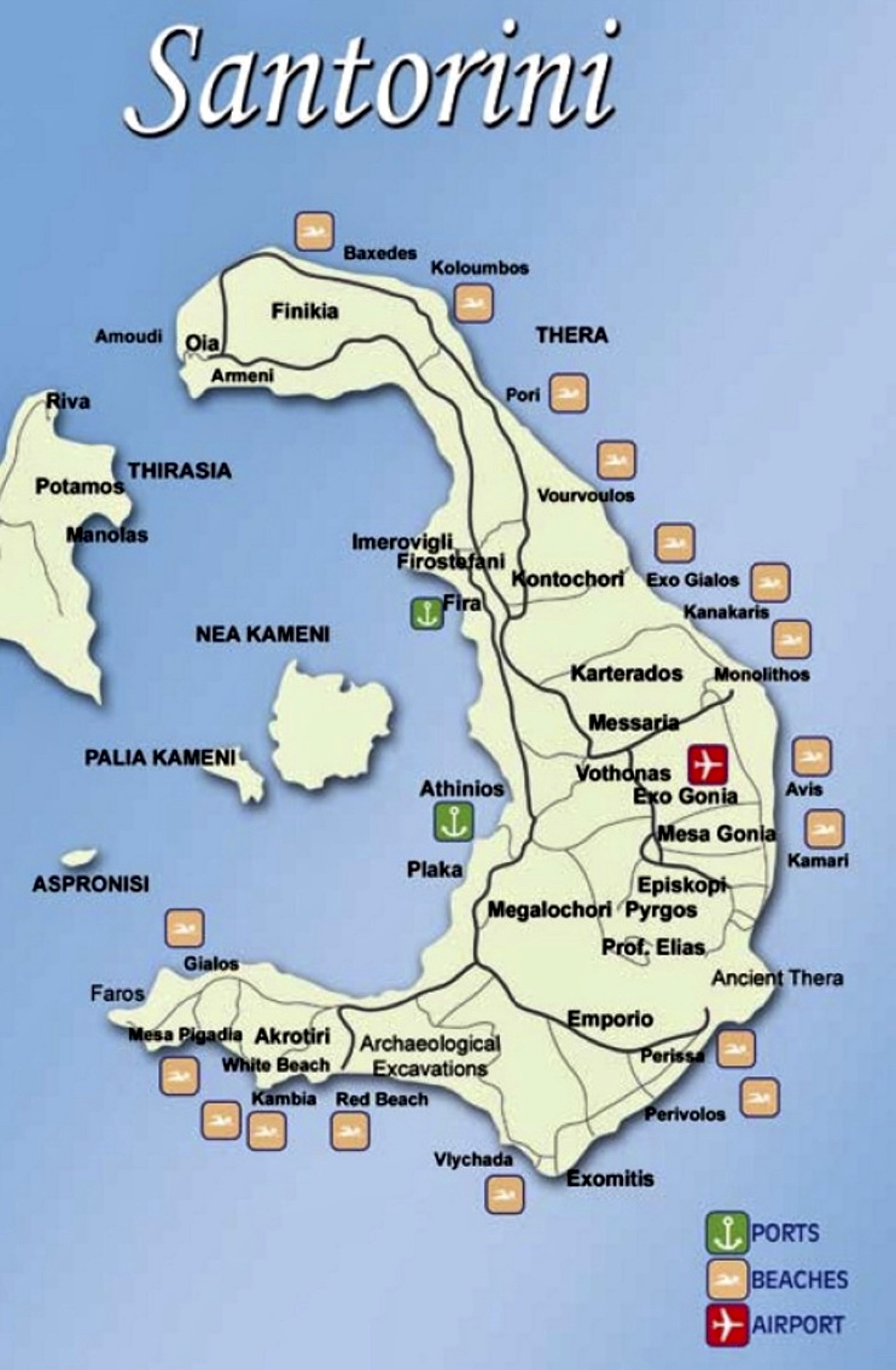
Santorini is unique. The island is what remains of a collapsed volcano crater.
Thousands of years ago, one of the largest volcano eruptions ever recorded caused the circular volcano to sink, leaving a flooded caldera (or crater) with surrounding cliffs of volcanic ash deposits and layers of lava.
We were in Santorini four days and had plenty of time to check out the island.
In late-March (their winter season), an average day consisted of brilliant sunshine until after lunch, clouds and windy afternoons with short rain showers, and lovely sunsets each evening.
Get on the water!
Don’t just get off the beaten path, get off the main island. Organized boat and catamaran tours visit caldera sites, offer snorkeling and diving options, and make drop-offs at several beaches and wineries.
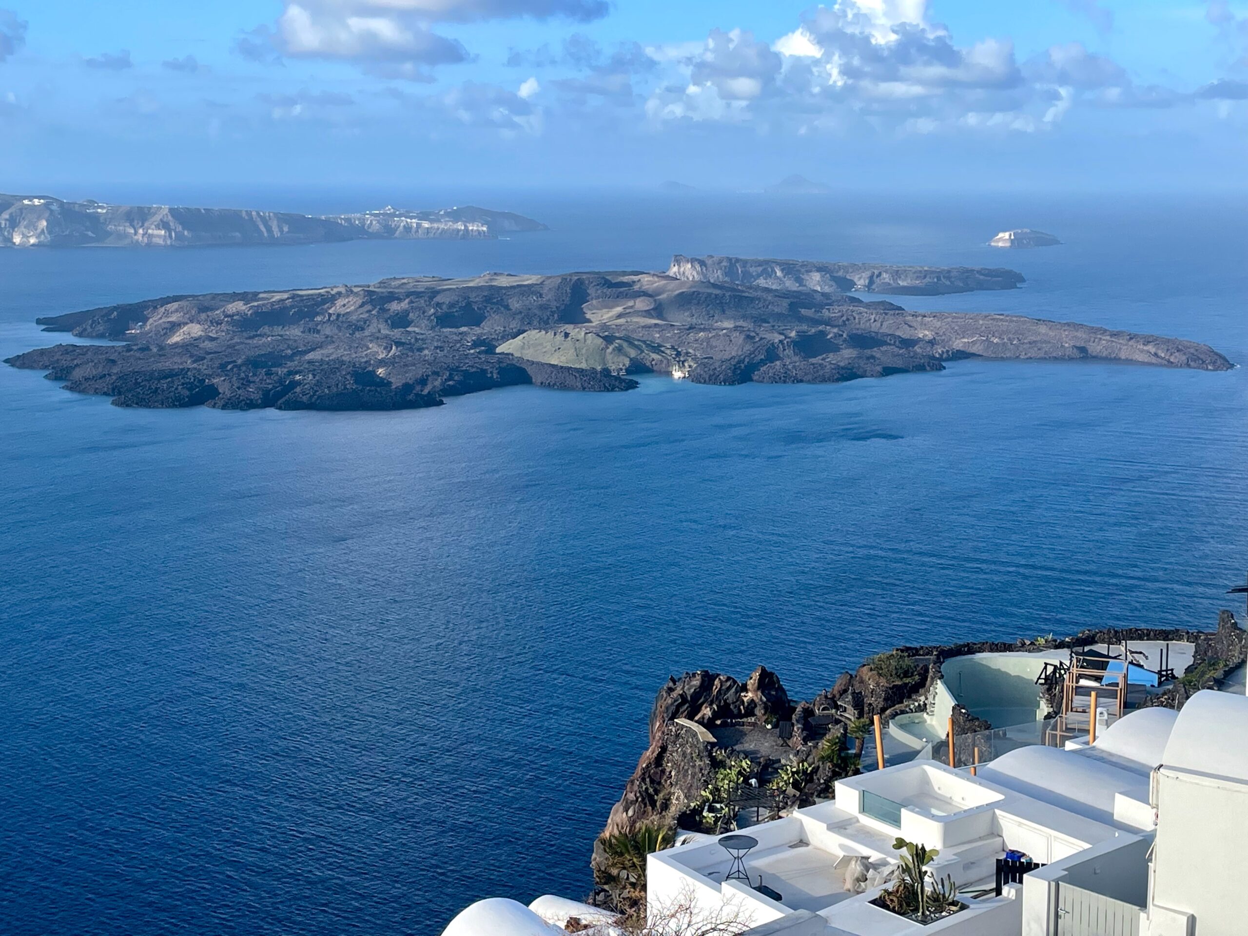
Nea Kameni Island
Hop on a boat or sunset catamaran and cruise over to the head of the volcano, Nea Kameni Island. Still active, the volcano’s last eruption was in 1950. Visitors can climb a gravel path to reach the top of the crater, walk the volcanic rim, and relax in the healing hot springs around the island.
What can you find south of Fira?
With the threat of rain showers one afternoon, we decided to drive to the covered Akrotiri archeology site and explore the southern side of Santorini.
TIP: With a car, it’s easy to get around the 15-mile island. Buses, taxis, shuttle boats, and tours are active as well. Don’t be afraid to use the KTEL bus system which will reliably get you almost everywhere on the island for around 2€.
On the eastern coast (we drove the west coast), you’ll find popular black sand Kamari and Perissa Beaches, and the 8th century BC fortress ruins of Thera with sanctuaries, an agora, and temples. The highest point in Santorini is the Monastery of Prophet Elijah near the castles of Pyrgos and Emporio (both built to protect their villages from pirate invasions).
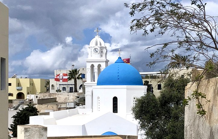
Megalochori Village
On Santorini’s west side is the 17th century village of Megalochori, known for its authentic underground pirate caves (free to visit), excellent vineyards, and caldera views.
The wine industry is a big part of Santorini’s culture and economy. Dating back more than 3,500 years, evidence shows the Minoan Akrotiri civilization grew grapes and cultivated vines on the island.
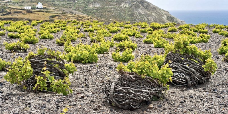
We saw basket-like grapevines (below) all over the island using the kouloura method. Vines are pruned and woven into low-to-the-ground wreath shapes to protect the grapes from wind damage and to help vineyards survive intense island sunlight and very little rainfall.
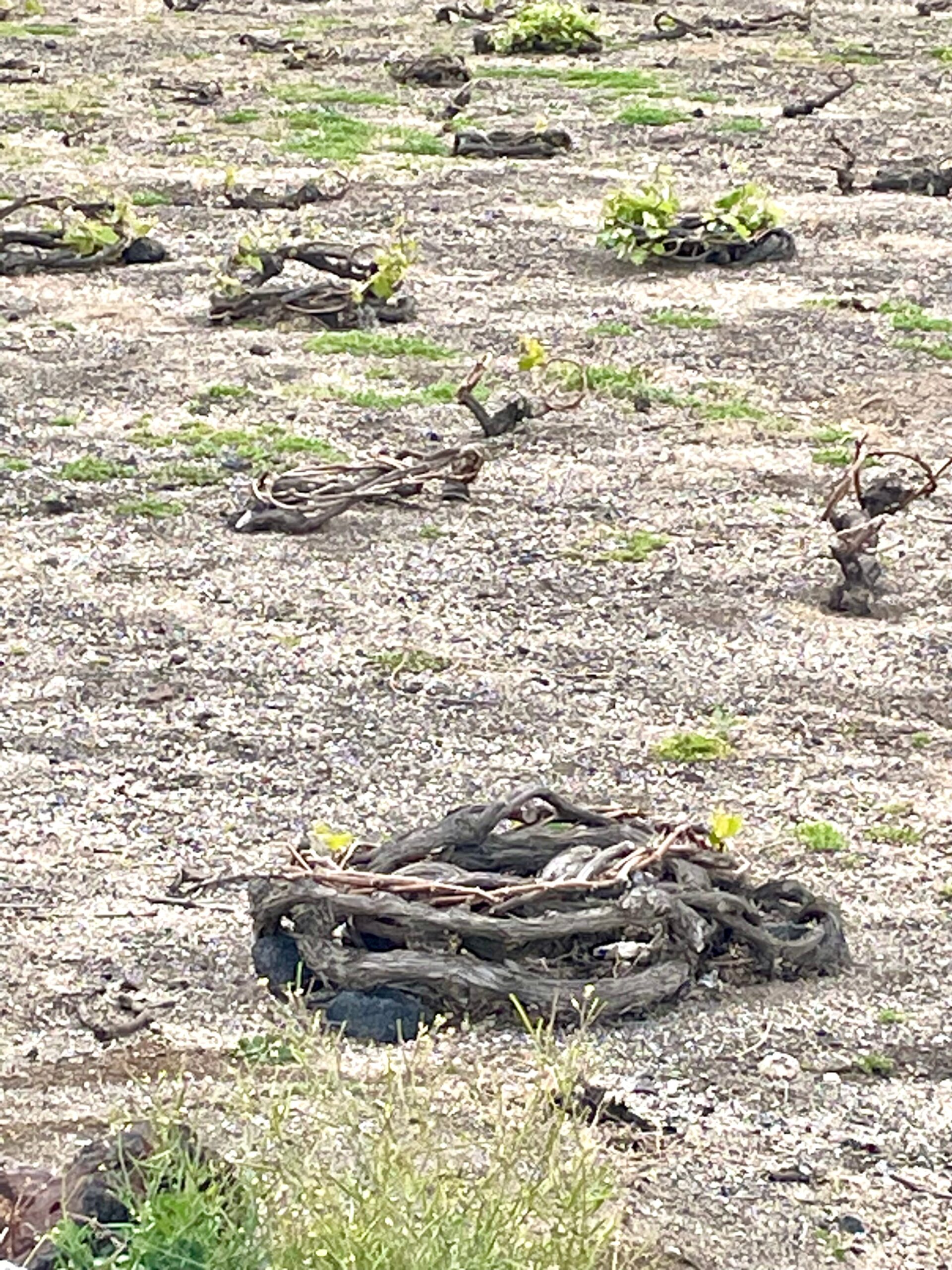
Not your tradtional vineyard!
Greece’s most famous wine is Vinsanto, the dry white and amber-colored wine made from sun-dried indigenous Assyrtiko grapes (not to be confused with Italy’s Vin Santo; the only similarity is the name).
Here are five of the 12-or-so local vineyards in this area open for wine tours and tastings: Popular Santo Wines, located in Pyrgos, has the most comprehensive tours and specialty wines, a restaurant, and boasts great caldera views. Open year round, Boutari Winery in Megalochori is Greece’s most historical family-run winery (1879) and the first to do public wine tastings.
All in Megalochori: Venetsanos Winery (with stellar views) is smaller, charming, and was an early pioneer of industrial winemaking techniques. Intimate Gavalas Winery has been family-run for five generations with a focus on reviving and producing the Katsano grape from extinction. Since the 1950s, Canava Antonis Arvanitis Winery has an authentic and traditional wine tasting experience and is family run. The Arvanitis’ also have a bakery and sell goodies grown on their land.
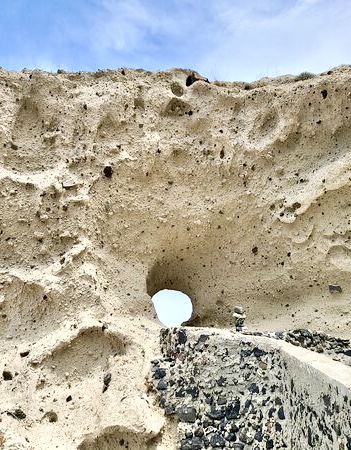
While researching the Megalochori area, I found a few surprises on Google Maps.
The Heart of Santorini is located above the secluded Church of Saint Nicholas.
It’s a hidden heart-shaped rock window in a cliff with views of the caldera, volcano, and the Aegean Sea.
Apparently, the secret Santorini Heart window is known for romantic proposals and great views of the sunset.
You can either take the bus or drive, but either way: use Google Maps to find the parking lot and trail which zig-zags down to the hidden window and church.
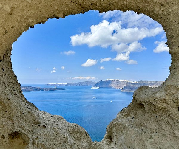
The mysterious Heart of Santorini
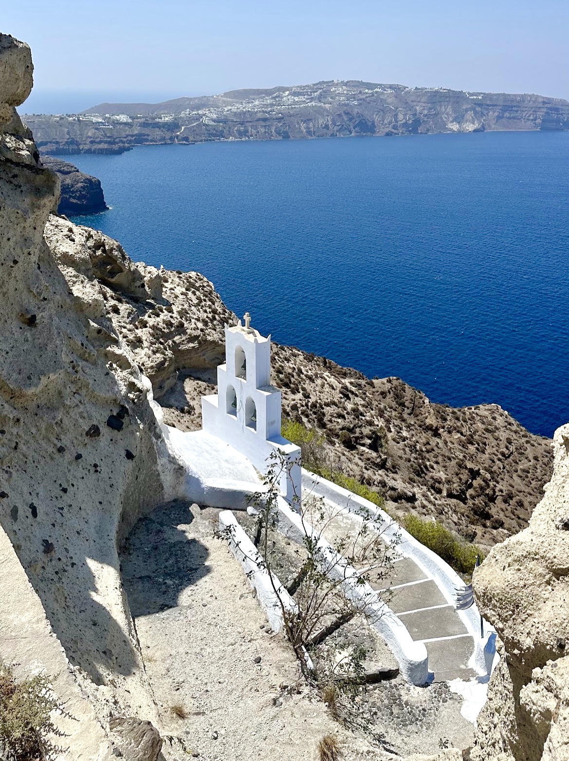
Church of Saint Nicholas
Keep going down the same path to find the Church of Saint Nicholas (Agios Nikolaos). The bell tower sits above a tiny church completely carved into a rock cave.
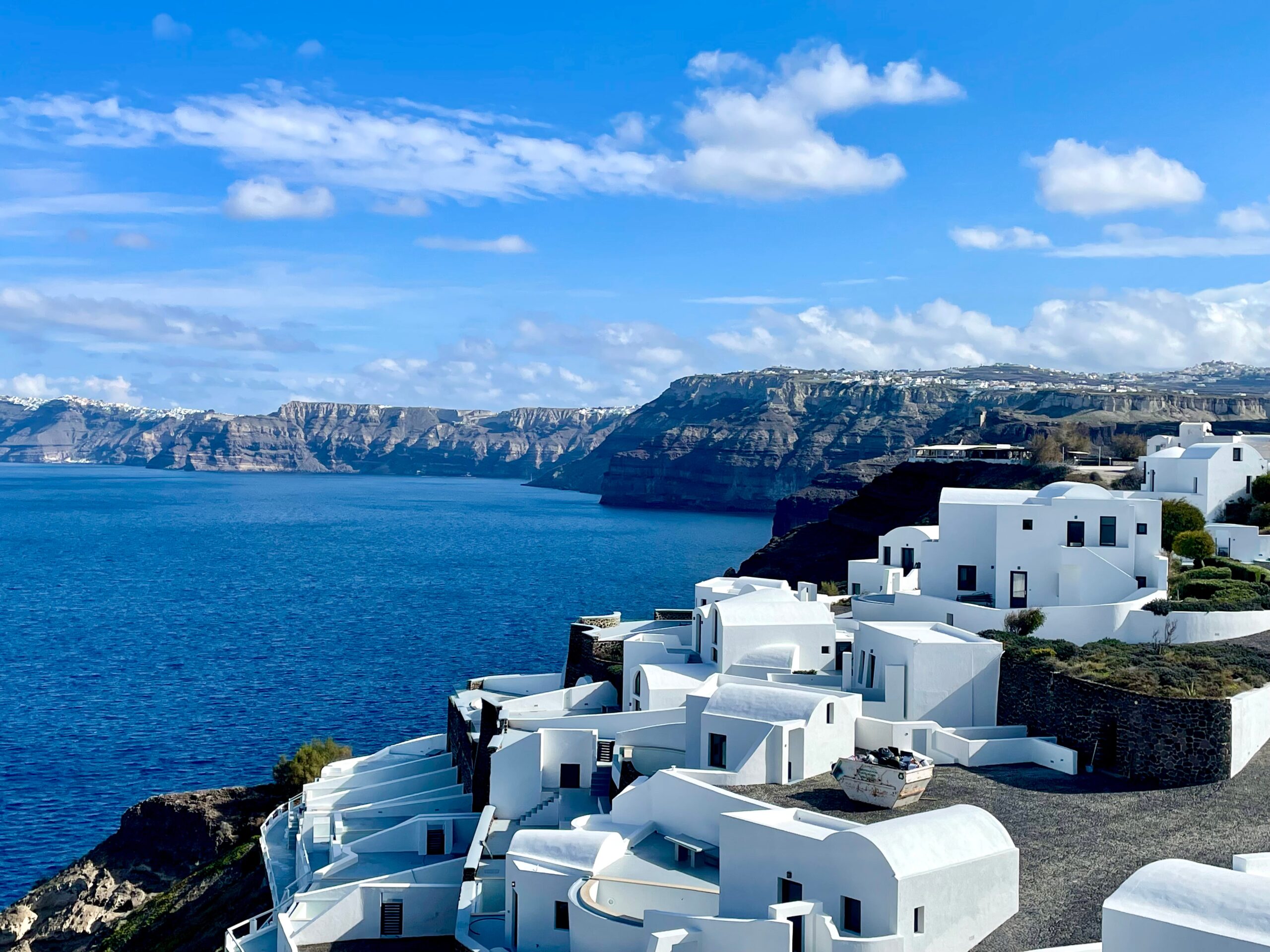
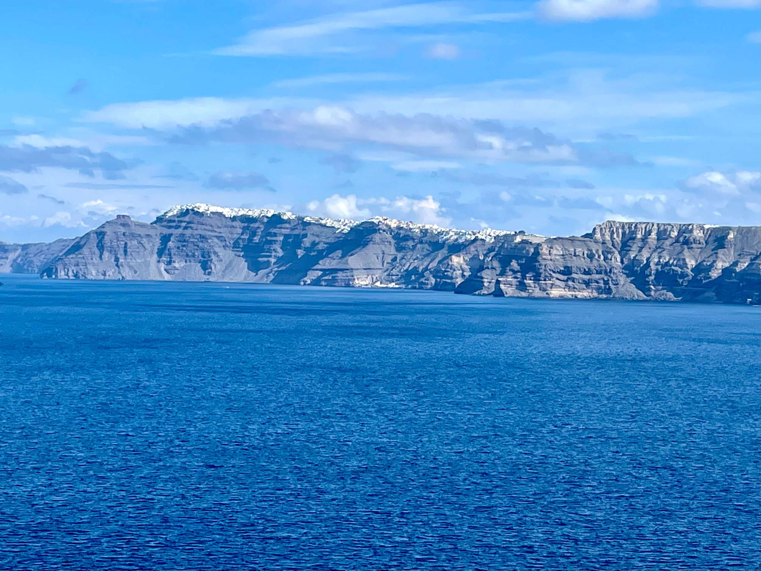
We made a few stops along the way to take pictures of pretty whitewashed villages and the caldera views of Fira, Firostefani, and Imerovigli.
Akrotiri Archaeology Site
Near the southwestern tip of Santorini is the prehistoric settlement of Akrotiri, a Minoan civilization buried in time, and ash, from a 1630 BC earthquake and volcano eruption similar to Pompeii, Italy (but 1700 years earlier). According to Geologists, the volcano eruption is the biggest natural event ever recorded by humans.
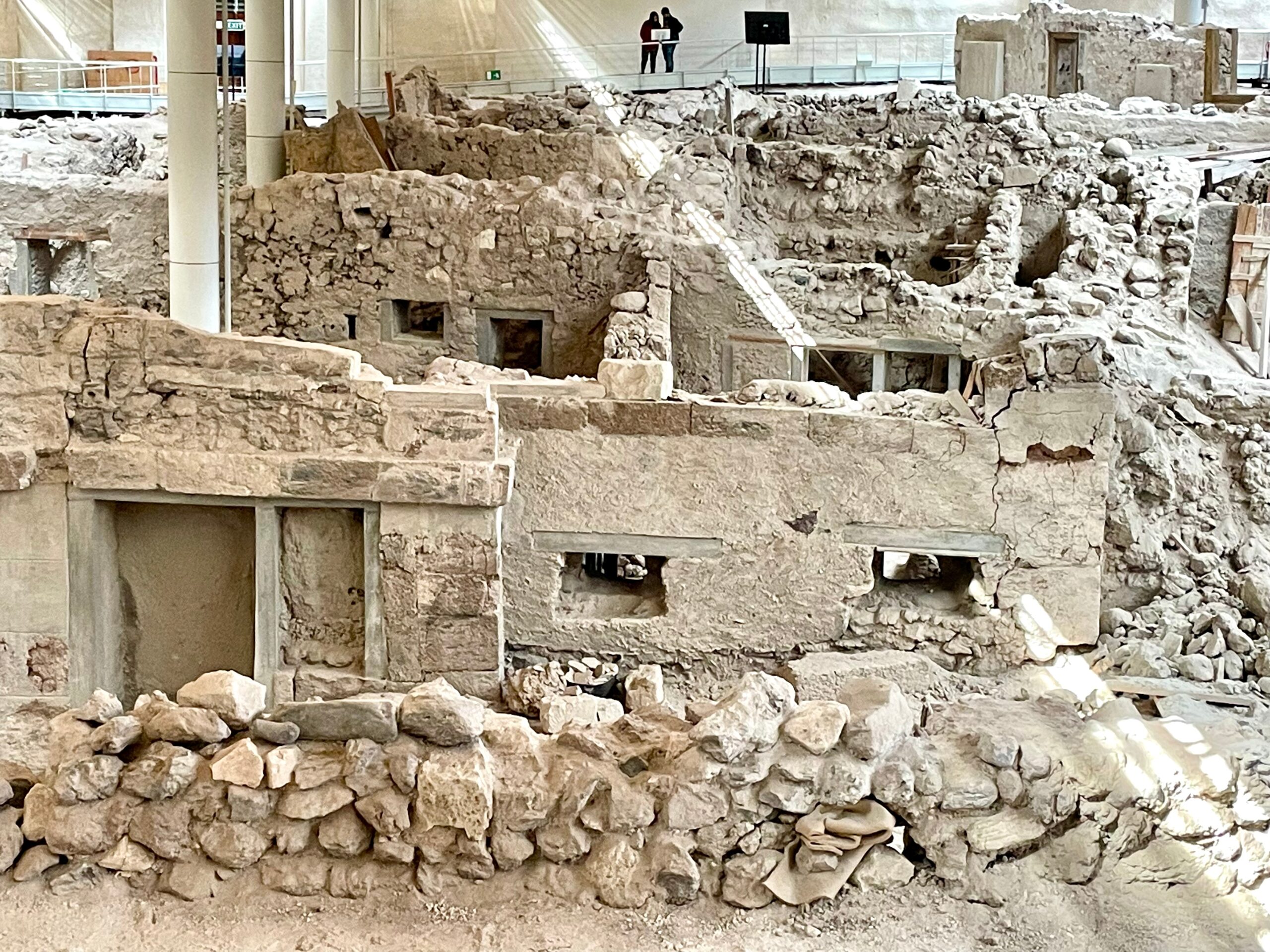
Workmen discovered Akrotiri in the 1860s while quarrying volcanic ash for the Suez Canal. Excavations began 1967 by Spyridon Marinatos, a professor at the University of Athens. Akrotiri’s inhabitants must have had advanced warning and fled the island before the volcano eruption–as no human remains have been found.
Ash and lava destroyed this civilization but also preserved it. To date, about 6% of the intact city has been unearthed. Archaeologists think it could take a century to completely finish the excavation: slow work!
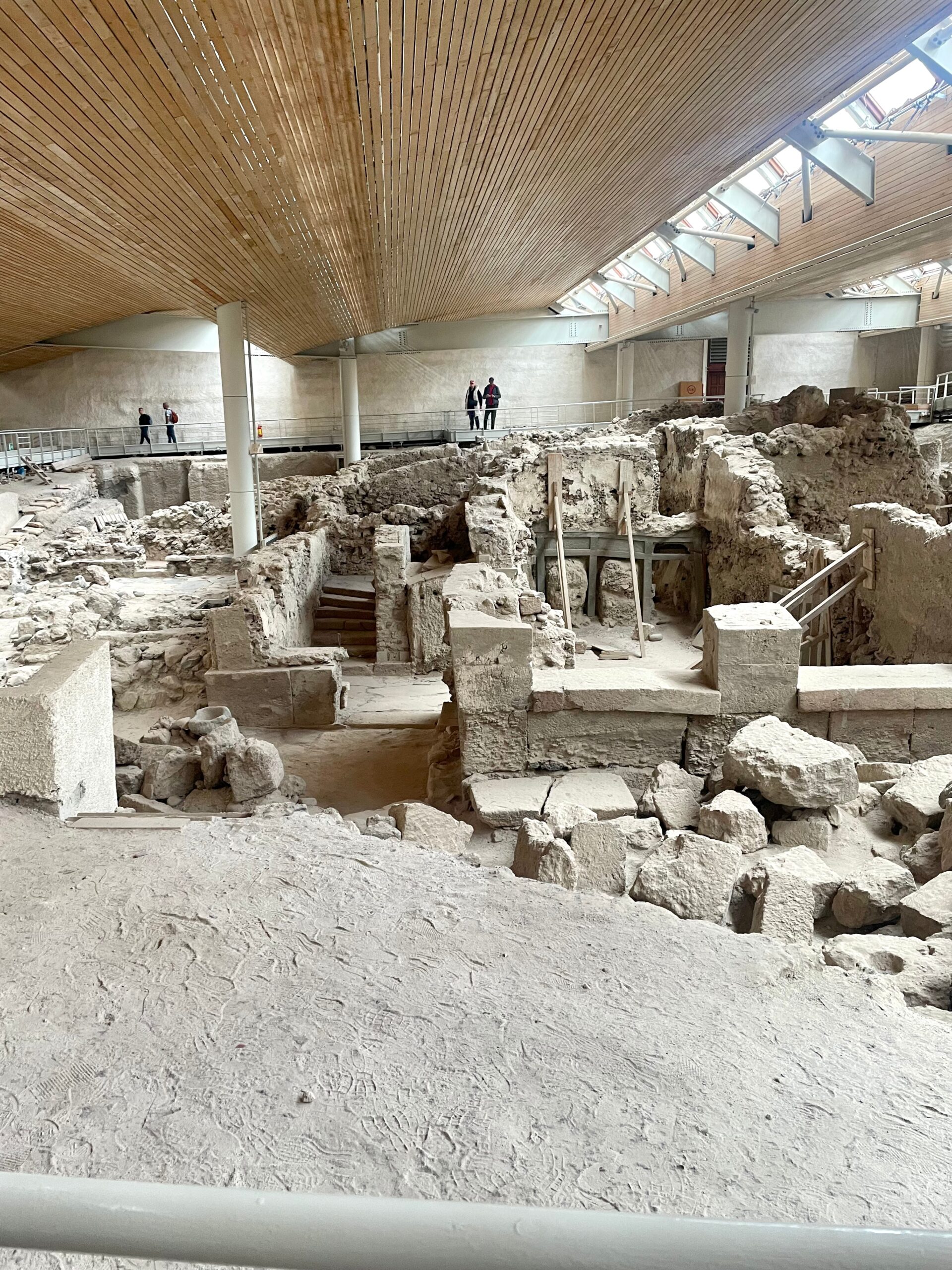
A convenient covered site for both visitors and archaeologists.
To preserve Akrotiri, it is enclosed with a bioclimatic protective roof making it easy for visitors to climb around and into the site on elevated walkways. Guides are available; however, good signage, photos, and video boards are helpful. We picked up information and walked the site on our own.
Excavations have revealed over a million square feet of a prosperous settlement which once had 30,000 inhabitants. The well-developed Bronze-age city included public roads, a water supply, a sewer network, elaborately decorated two and three-story houses, baths, workshops, warehouses, a cemetery and a harbor.
Stone from nearby quarries was used as the main building material. They must have had early issues with earthquakes because building walls were reinforced with wooden beams from Crete.
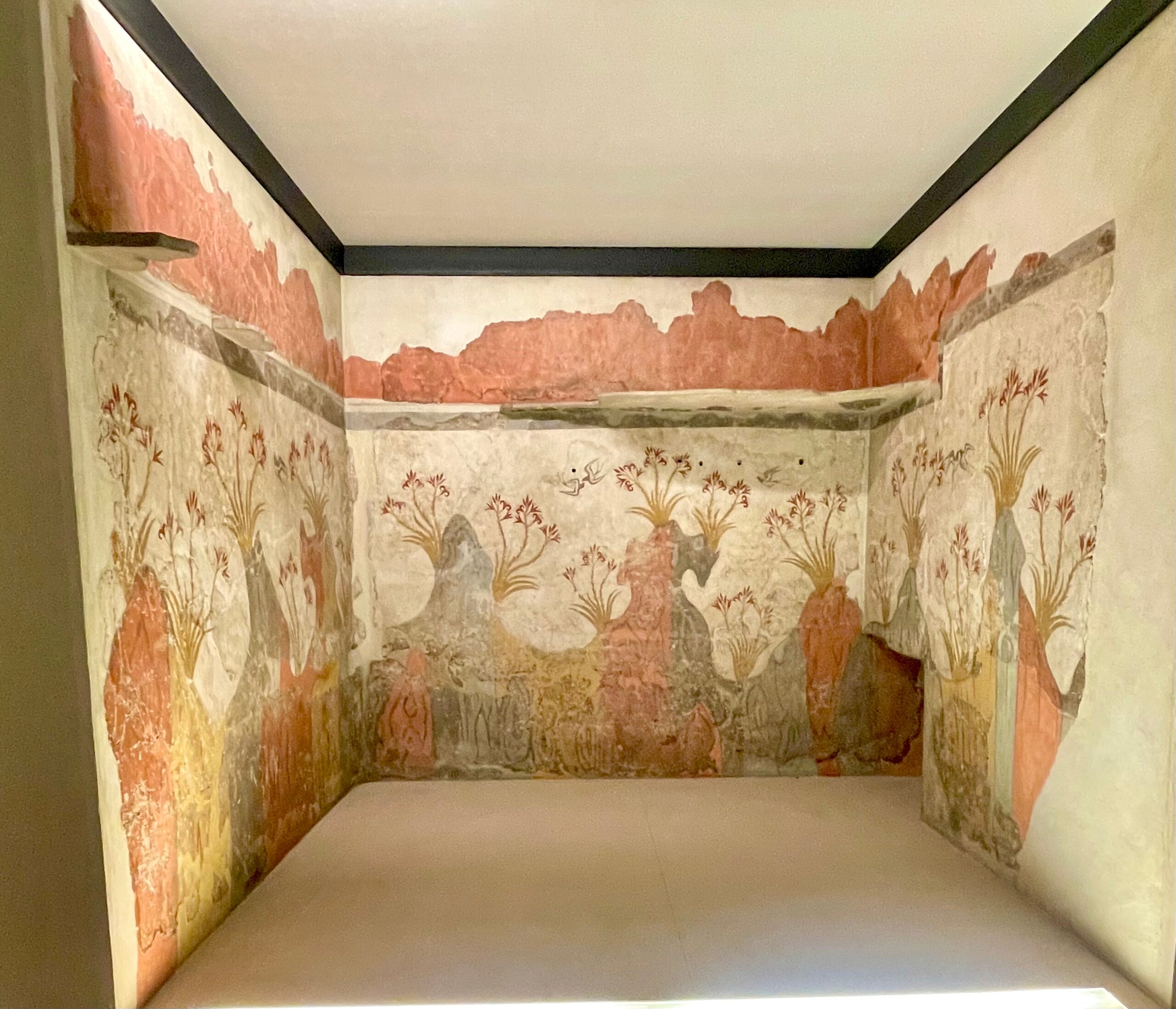
A room mural of the “Spring” from ancient Akrotiri.
Impressive Minoan-style wall frescoes of flowers, people, animals, rituals, and everyday life were found in almost all the buildings (preserved by mud), along with exquisite art, furnishings and everyday household items. I took these mural photos at the National Archaeological Museum (Akrotiri section) in Athens.
The Boxer fresco (below) depicts two young boys wearing belts and boxing gloves and dates back to 1700 BC. Athletic competitions might have been a right of passage into adulthood for ancient Minoans.
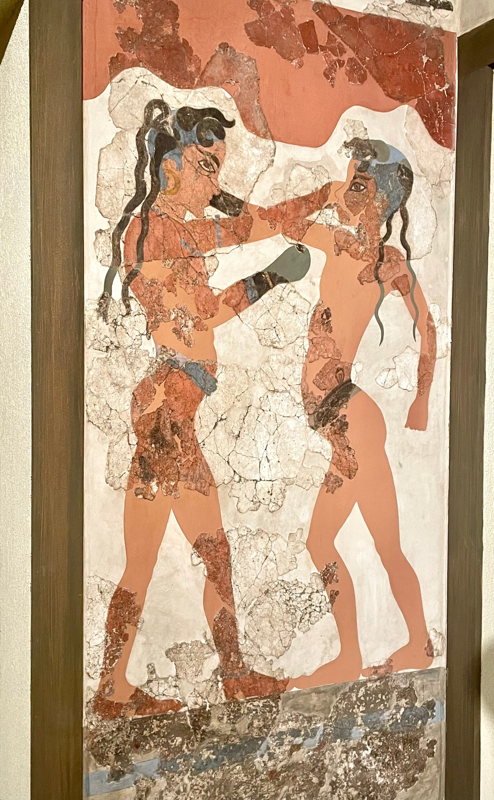
A fresco found at the Akrotiri site of two young boys boxing.
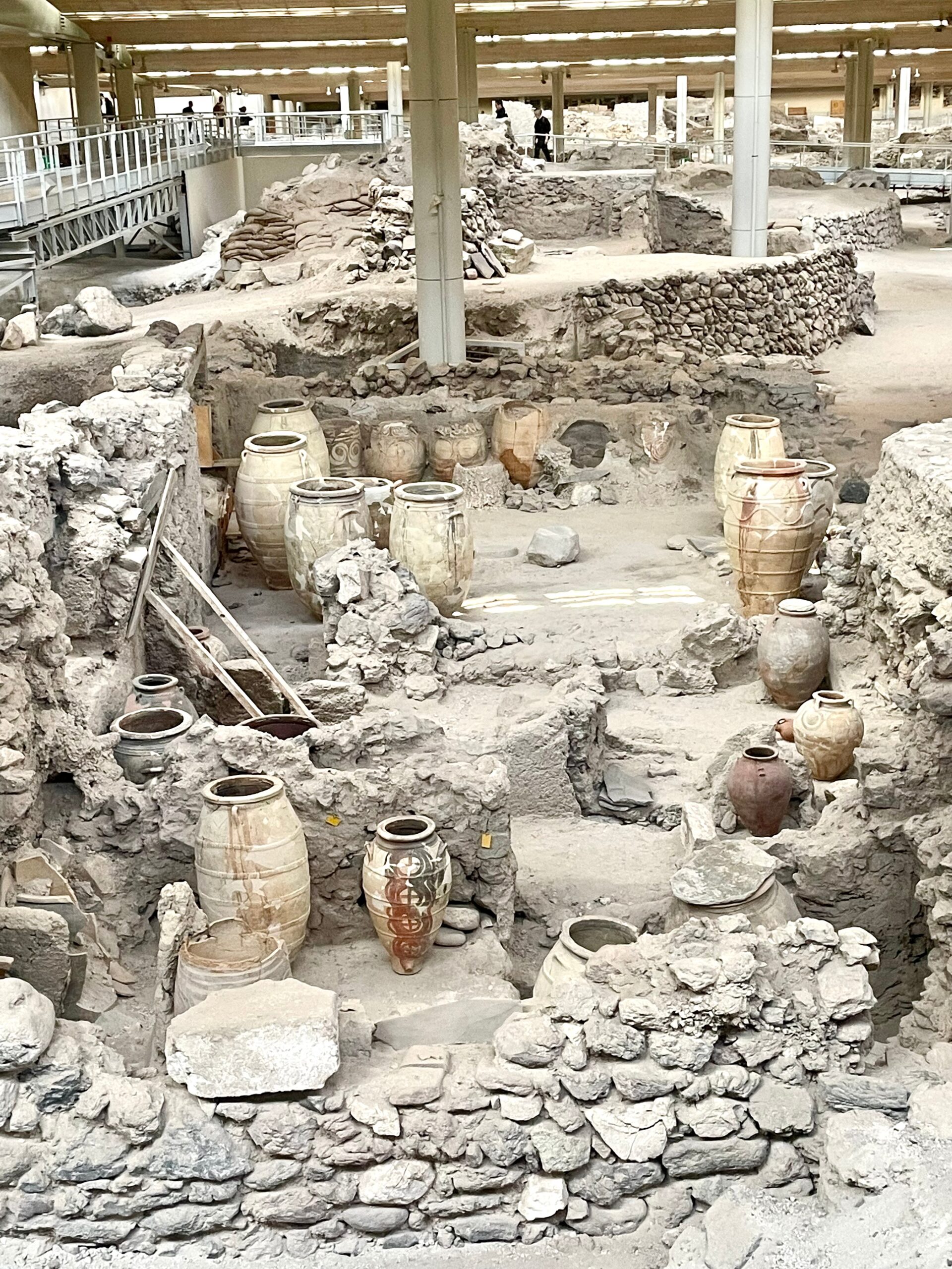
Storage jars in the Pithoi Storeroom.
Evidence of 6,000 year-old pottery placed the island’s first settlers as Neolithic. The first room excavated in 1967 was the Pithoi Storeroom. Over 5,000 vessels of various types and sizes were found throughout the site, but this room was full of large storage jars known as pithoi.
Leftover food (beans, flour, and barley) stored in jars were found in addition to slaughtered animals archaeologists feel were hung from ceiling beams ready to be butchered. In a nearby storeroom, baskets with petrified fish and sea urchins were found, plus an entire milling facility.
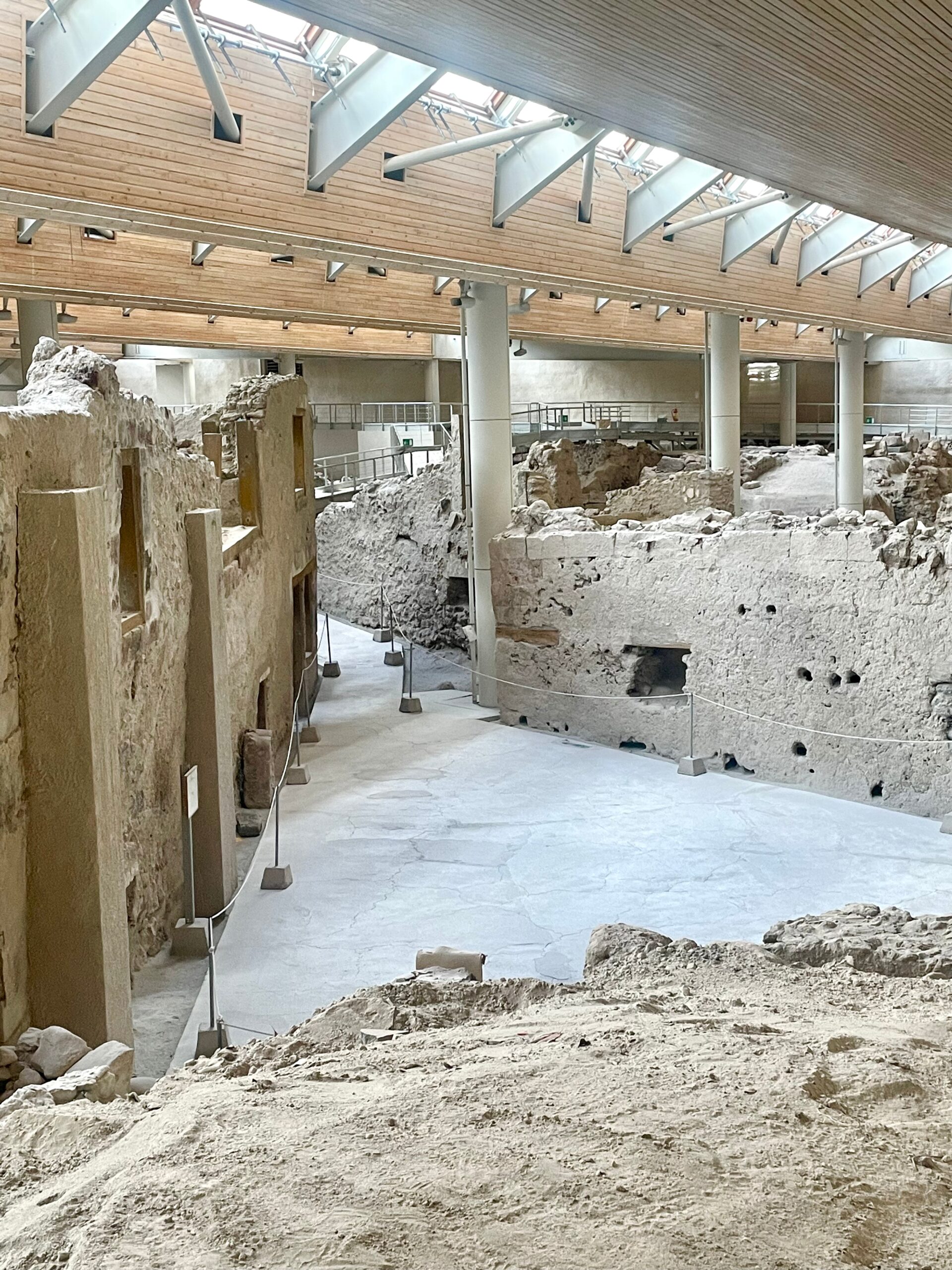
Triangle Square
Excavated Triangle Square is the largest public square with buildings on three sides: the West House (where the most comprehensive frescoes were found), Building Complex Delta, and the still unexcavated House of the Anchor. The grand West House had three floors, sixteen rooms, plus bathrooms.
Note: The site operates on a “winter/summer” timetable. Schedules all over Greece seemed to be “just a suggestion,” so check daily for hours.
Red Beach, Akrotiri Lighthouse, Black and White Beaches
On the south coast, there’s a string of beaches famous for their multi-colored sand and dramatic cliffs. Santorini’s beaches are not its main draw, but Red Beach is a natural wonder and well worth a visit. This beach gets its name from the steep 900-foot red cliffs created from volcanic lava.
When it’s warm, beach chairs and umbrellas are available, and it’s so much prettier than it was this rainy afternoon.
Access to Red Beach is by both land and sea. Boats from Fira and Akrotiri drop off at Red, Black, and White beaches. Buses drop off at the Akrotiri Archaeology site–which requires a walk to the Akrotiri Beach parking lot. From that car park, there’s a 10-15 minute walk to the beach.
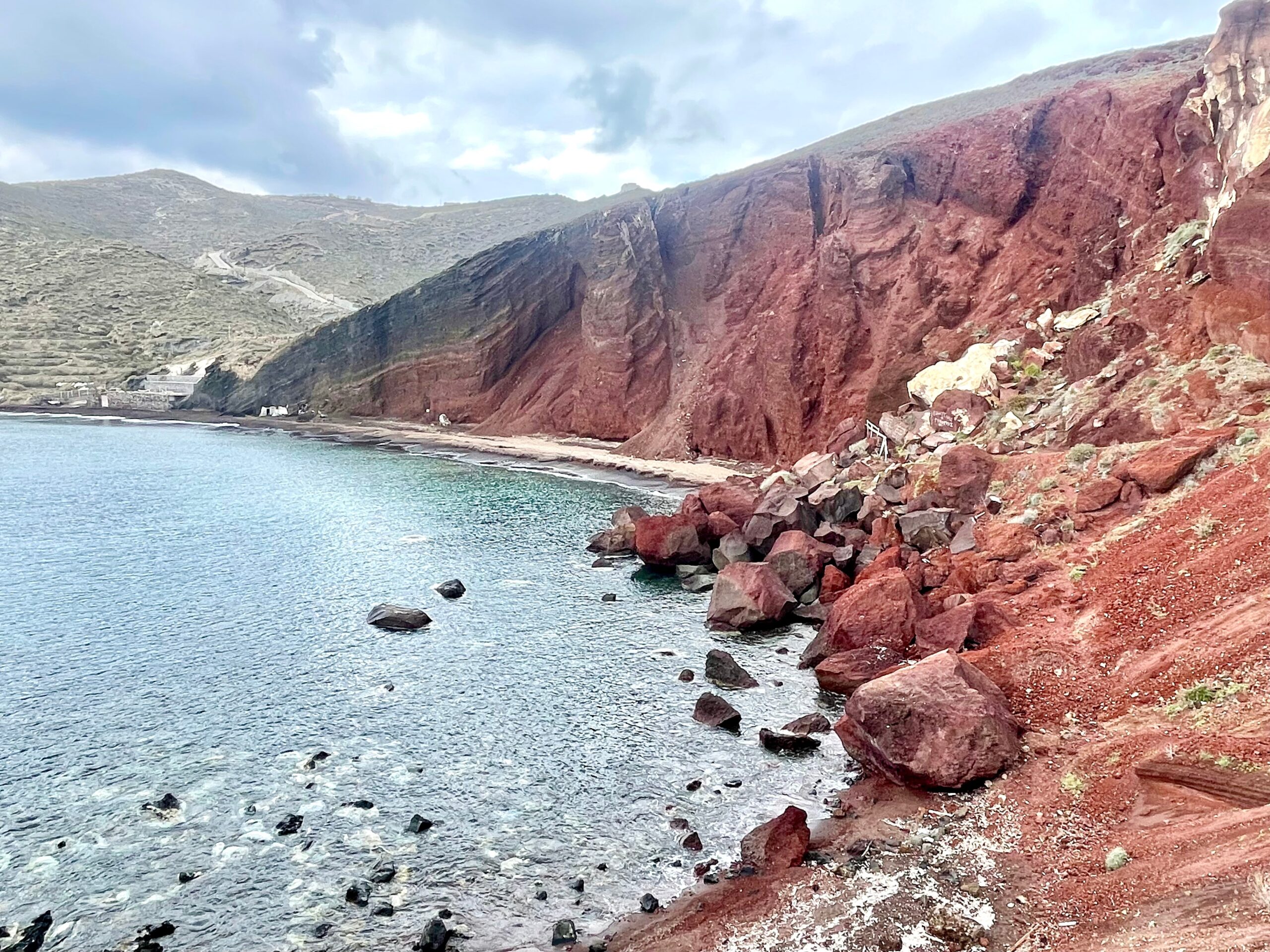
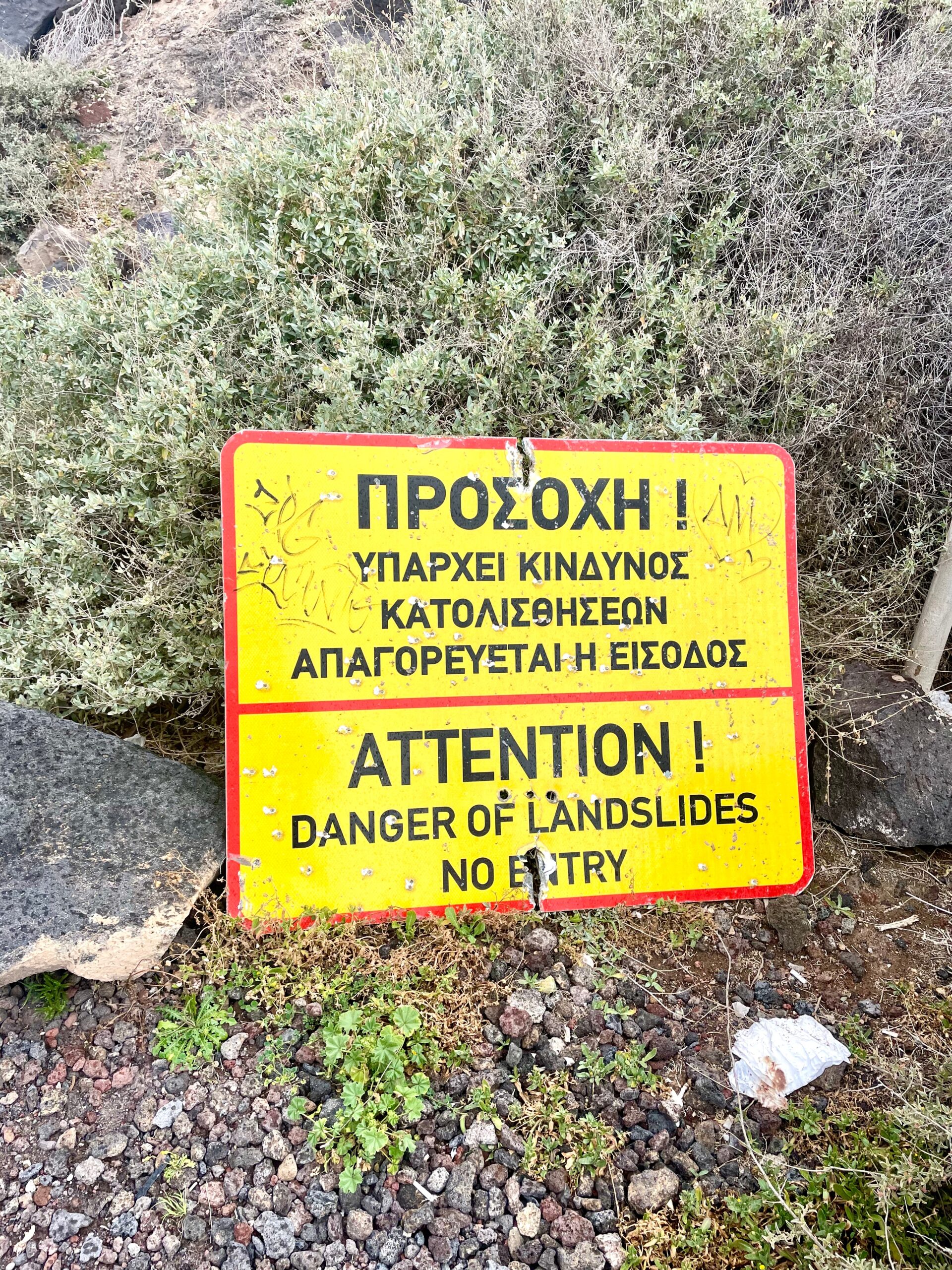
Look for signage as walking to Red Beach is often discouraged because of dangerous rock slides. In 2023, we did “walk past” warning signs (tourists do appear to ignore the signs) but stopped here because of the rainy conditions that day.
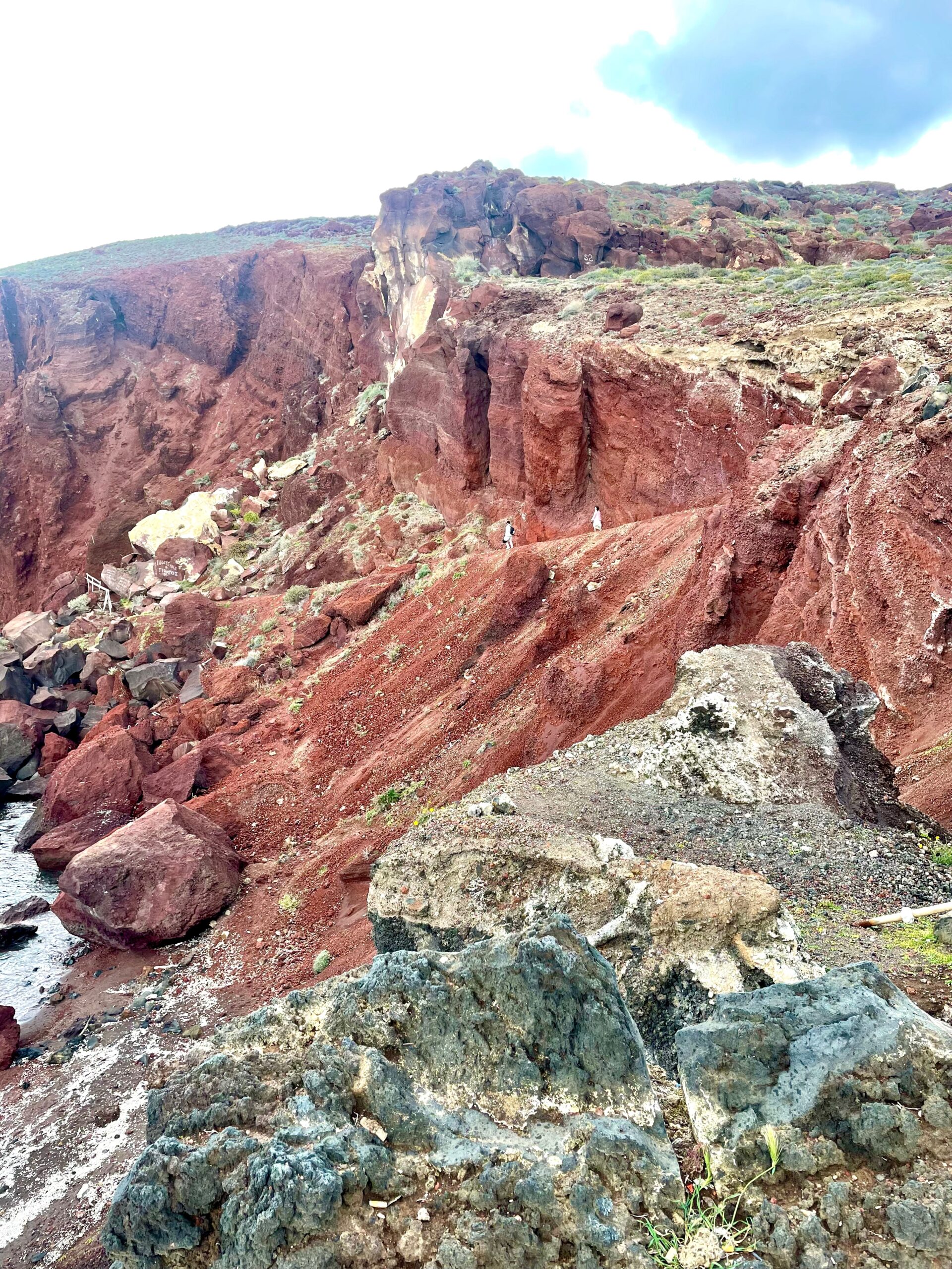
Can you find the couple who decided to hike down and over the rockslide in the above photo?
From Red Beach, we drove to the very end of Santorini and found the Akrotiri Lighthouse. It sits above the coastline doing its job to shine brightly and assist ships passing by. It belongs to the Greek Navy and is not open to the public, but tourists still visit for the exceptional views and Santorini sunsets!
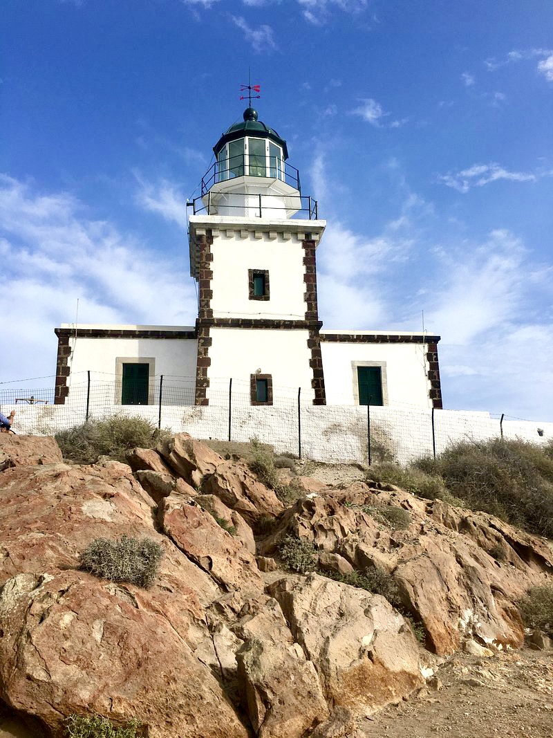
The Akrotiri Lighthouse
One of the oldest in Greece, the active lighthouse was built in 1892 by a French trading company. Parking is limited, and there is no direct bus to the site. It’s a good 15 minute drive (and more than an hour’s walk) from the Akrotiri archaeology site and bus stop.
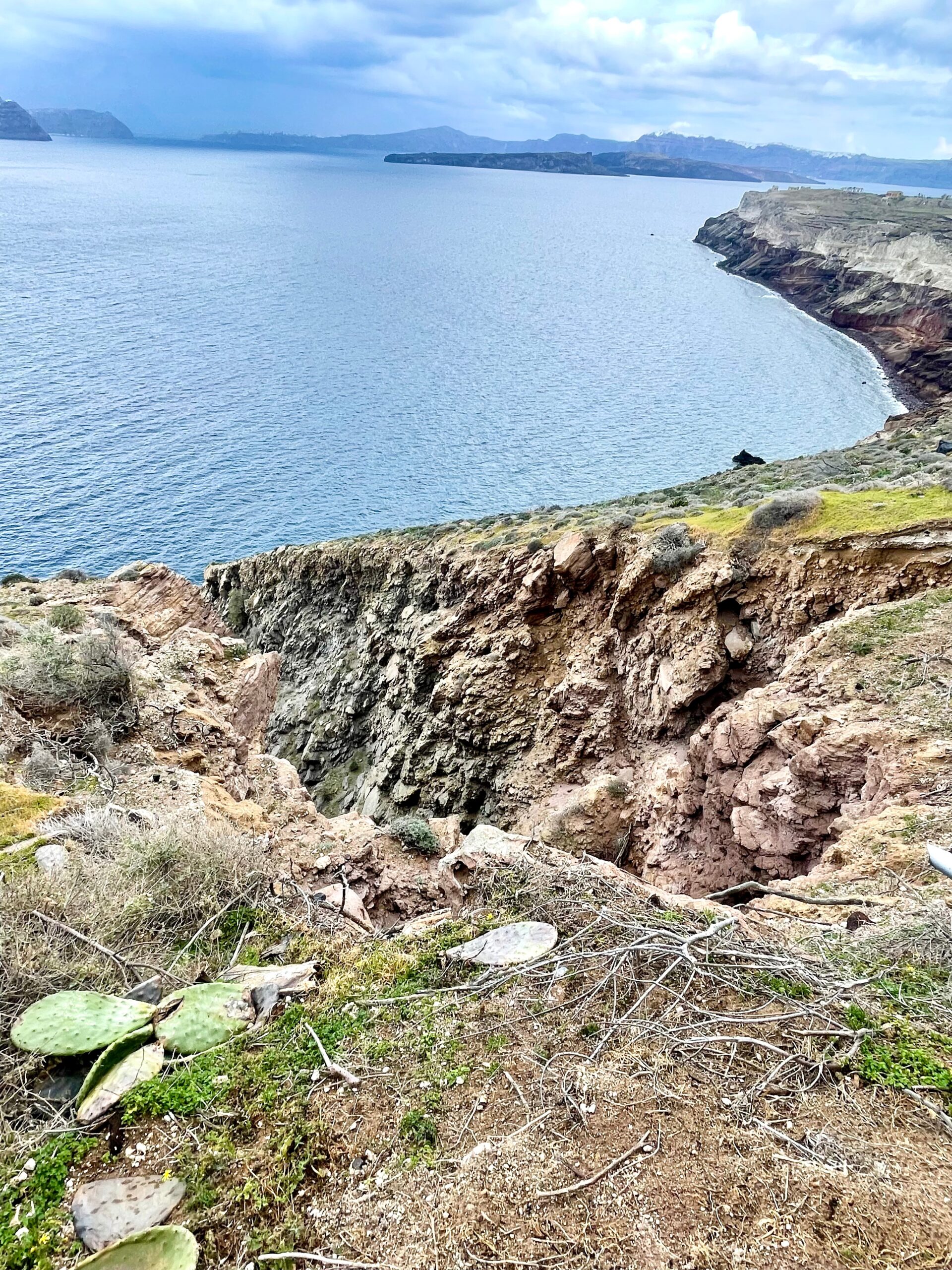
Caldera and volcano views from the Akrotiri Lighthouse on a rainy afternoon.
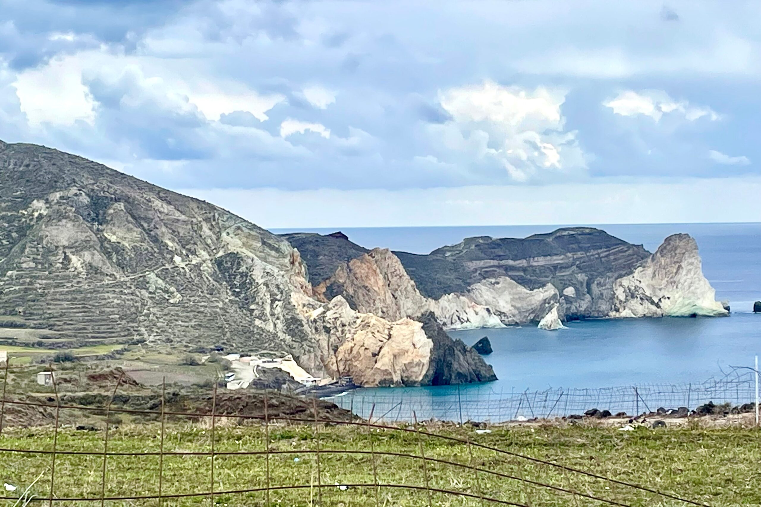
The dramatic shades of volcanic landscape
After we left the lighthouse, Google Maps showed us how to find Black Beach and the cliffs above White Beach. Up for an adventure, off we drove over the hill (above) on a bumpy, rocky, dirt road.
Black Beach (Mesa Pigadia) is one of Santorini’s hidden gems. It’s a true “black” sand and rock beach compared to Perissa and Kamari beaches.
I wouldn’t say it’s easy to get to by car. Parking is available in several places with a walk to the beach. When warm, beach chairs and umbrellas are set up to rent for sunbathing, and there’s a taverna. Water taxi boats also drop off and pick up between Black, Red, and White Beaches.
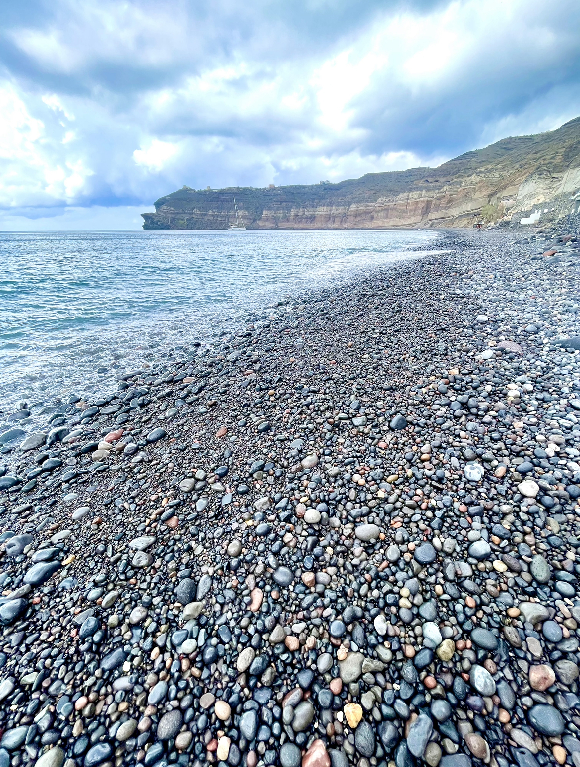
Black Beach
Santorini’s tiny White Beach (Letki Ammos or Aspri Paralia) is in the cove between Black and Red Beaches. It’s known for calm, crystal-clear waters hidden below rugged white cliffs. You can swim along the coast toward Red Beach and explore nearby sea caves, snorkel, cliff jump, and take kayak adventures to White Beach.
It is not accessible by car; it can only be reached by boat. If driving, you can see it from above, but there’s no route down to the beach. Boat shuttles do not dock: they drop visitors off in the water who then “wade in” or swim to shore. A few catamaran cruises anchor for swimming and snorkeling.
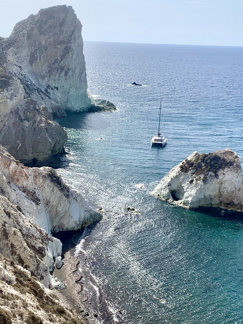
Turquoise water and cliffs near White Beach
Hike the Fira to Oia scenic clifftop trail
Up for an adventure? The hike from Fira to Oia is breathtaking! It’s a great way to escape the crowds and experience the natural beauty of Santorini.
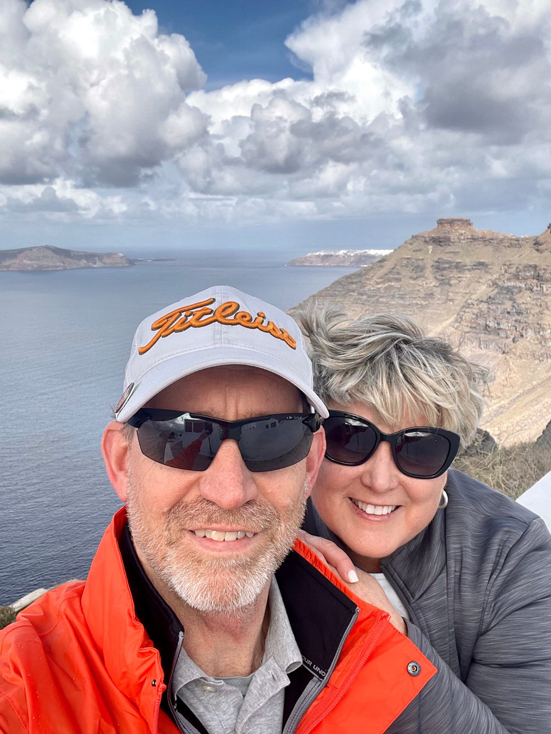
Know before you go: Hiking the caldera rim is a strenuous six mile hike up and down steep steps, cliff trails, and rocky pathways. Depending on your walking level, aim for around 4 hours of hiking, so go early morning or late afternoon to avoid mid-day heat with little shade.
TIP: If you plan to return by taxi or bus to Fira or Imerovigli (expect 2€ or less bus fare), take a screenshot or photo of the bus schedules.
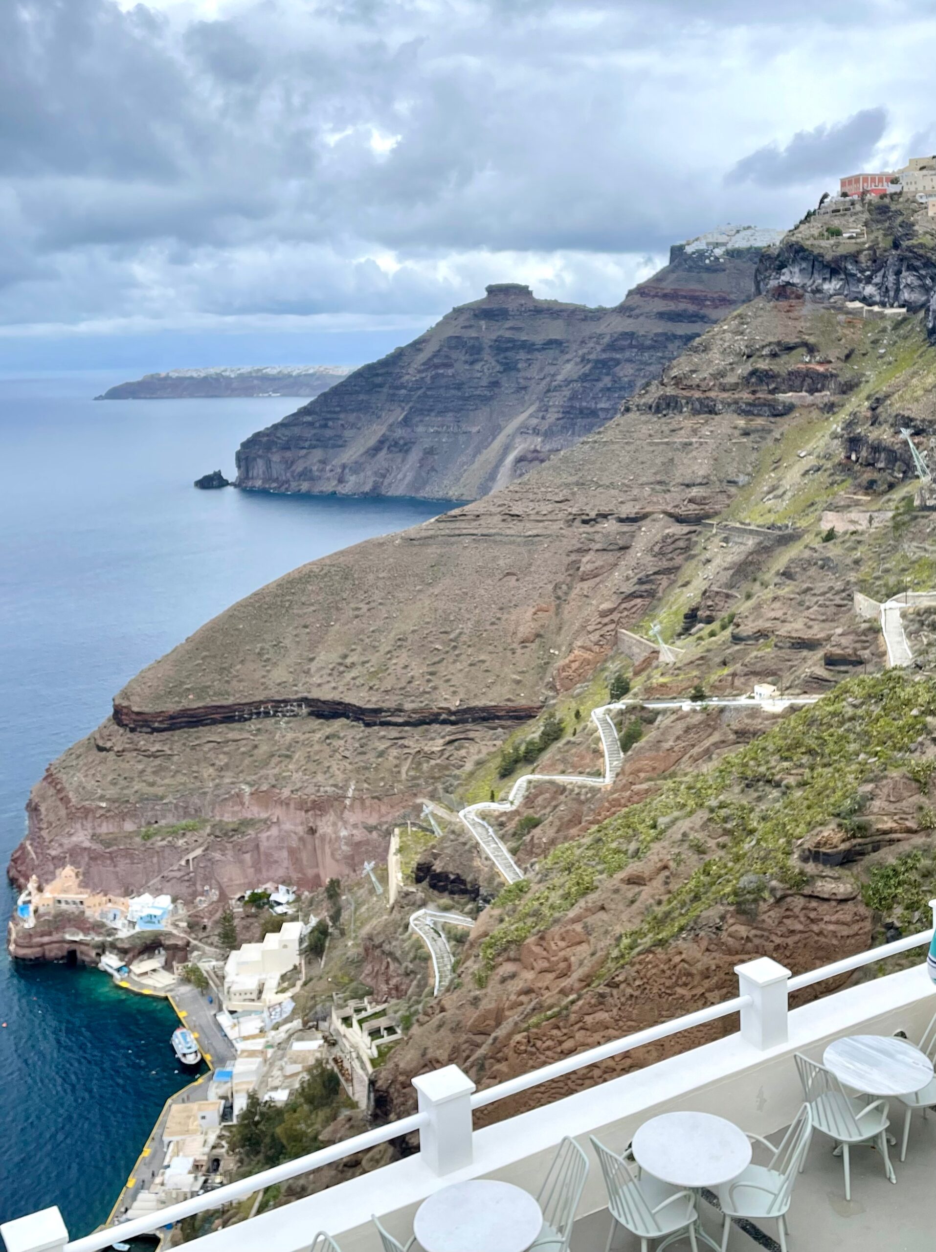
A view from Fira all the way to Oia
With amazing views along the way, wander and go at your own pace. Factor in time for photo stops, exploring churches, climbing Skaros Rock or stopping for meals. Check the weather and aim for a cloudy day!
TIP: Take plenty of water, your camera, wear a hat, appropriate shoes, and sunscreen is a must–even in the winter. Buy water the day before and freeze it, if possible.
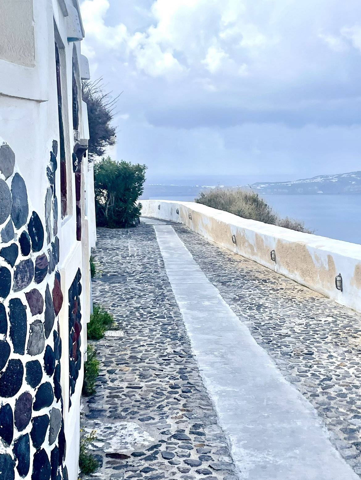
Choices: The Fira to Oia hike can actually be taken in either direction. Both are hilly, but from Fira to Oia, the gradient is steep for a shorter time and the directional views to Oia are better. You could also break the hike into two days, take the bus to Imerovigli and then hike to Oia, or simply hike to Imerovigli and Skaros Rock.
Officially, the walk begins at the Hotel Atlantis in Fira. Google Maps will provide the shortest route but not the most picturesque.

The trail is steep heading to Firostefani.
From the Atlantis Hotel (or anywhere in Fira), face the Aegean Sea and turn right. Walk north toward Firostefani on Nomikou M Street, and the sea will always be on your left for the entire walk.
The first section of the trail from Fira to Firostefani is pretty steep, and the two villages (once separate) have grown together over the years.
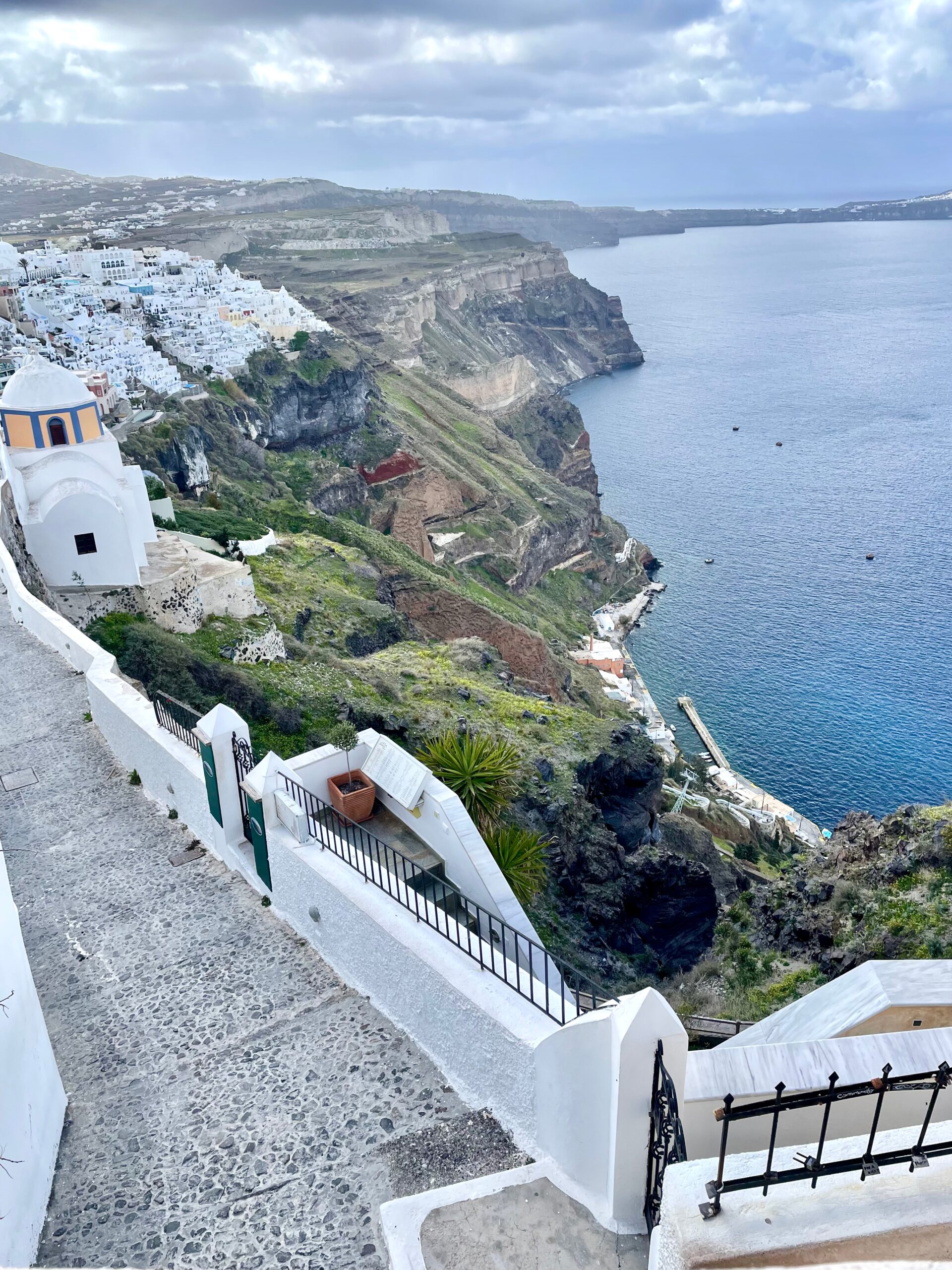
Looking back to St. Stylianos and Fira, Santorini’s capital
Not only is Firostefani village popular for panoramic villas, great restaurants and bars, it boasts one of the most sought after blue dome churches: The Three Bells of Fira (Agios Theodori or the Catholic Church of the Assumption of the Blessed Virgin Mary).
Decision time: Find the church on the trail (you will not be able to see the blue dome) or detour off the path and go above the church for the postcard picture below.
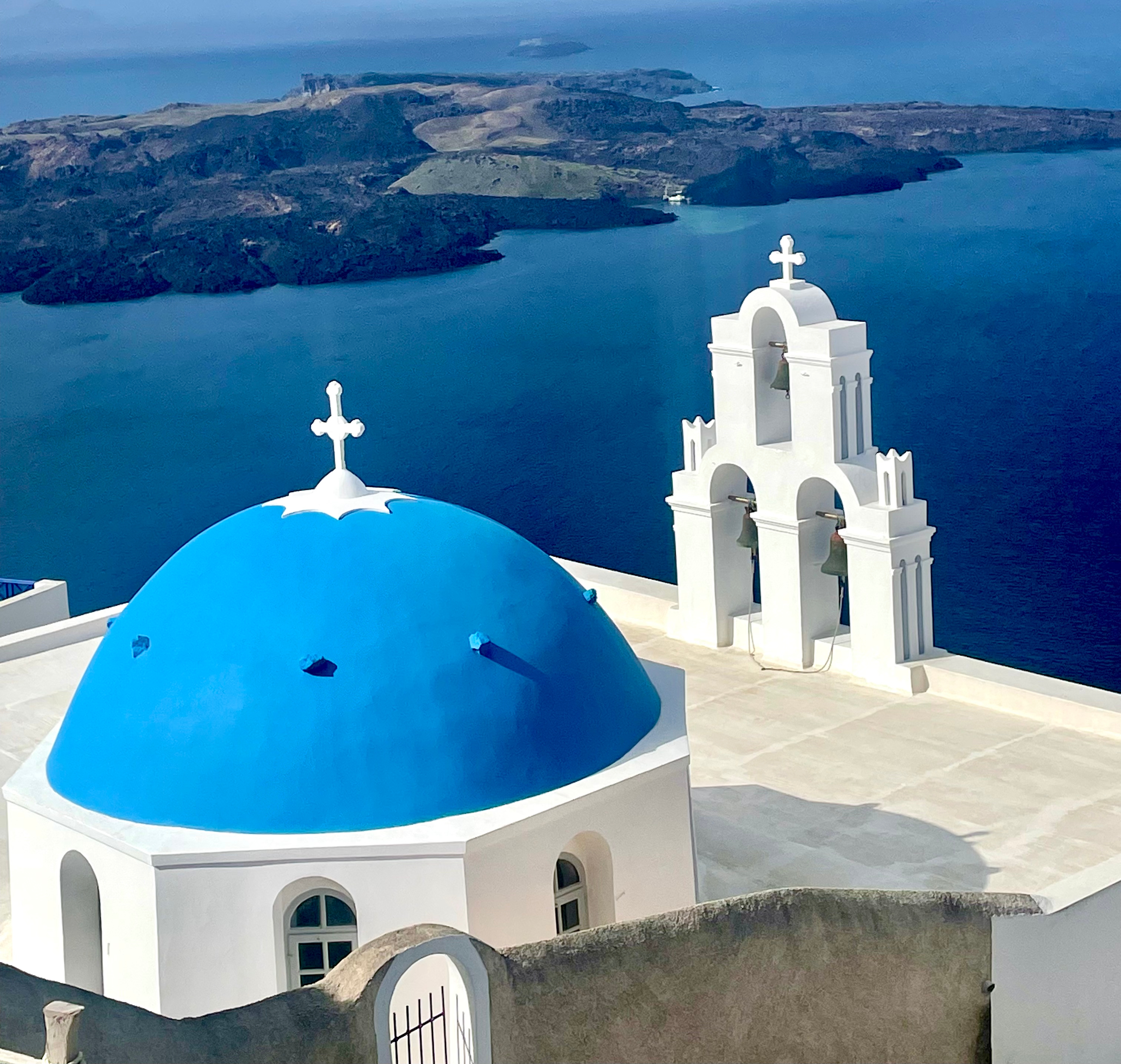
Directions if walking from the trail: (Use Google Maps and take a right when you reach the Art of the Loom Gallery to walk up to the viewpoint for the church. Take the next left and walk to the top of the hill to a small parking area. Walk toward the sea to find the church dome).
Directions if driving to the Three Bells of Fira: (Use Google Maps. Driving from either direction, exit at Firostefani. Turn onto 25 Martiou St. and drive .08 miles. Take the next left and immediately take another left. Veer to the right, going up and drive 0.10 mile to the viewpoint (space for 10-12 cars). If full, Parking Lot 6 is nearby. Walk toward the sea to find the church dome).
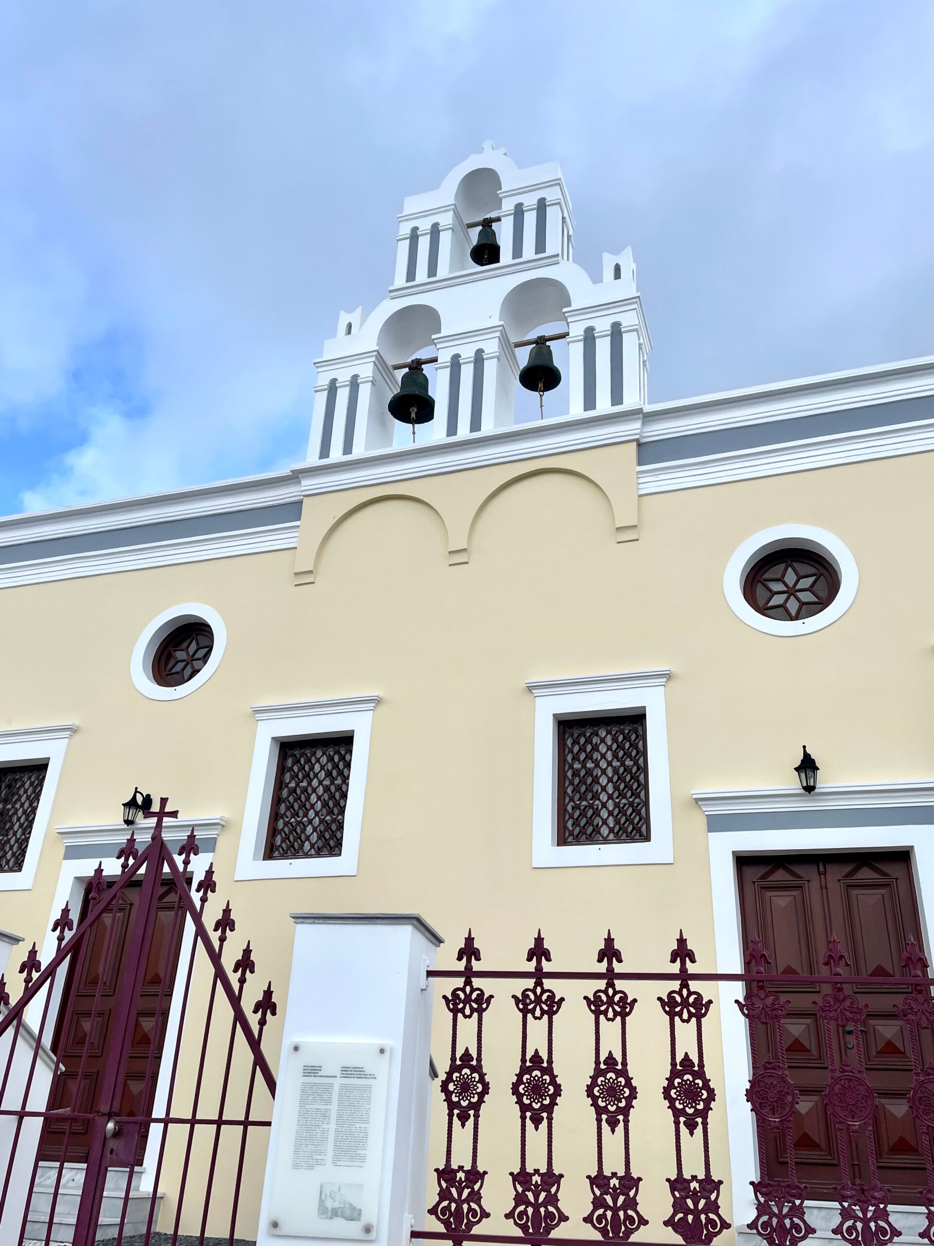
After photos, make your way back to where you left the trail and walk toward Imerovigli. The front doors of the Three Bells of Fira (above) will eventually be on your right. Although it is one of the most famous landmarks in Greece, the church is rarely open to the public. Inside is a precious icon of the Virgin Mary donated from Russia in 1570.
Between the two villages is a historical nunnery, the St. Nikolaos Monastery. Built in 1651 as an all-female convent, its first members belonged to the Castle of Skaros Gyzi family. It’s still operating today and has a small museum.
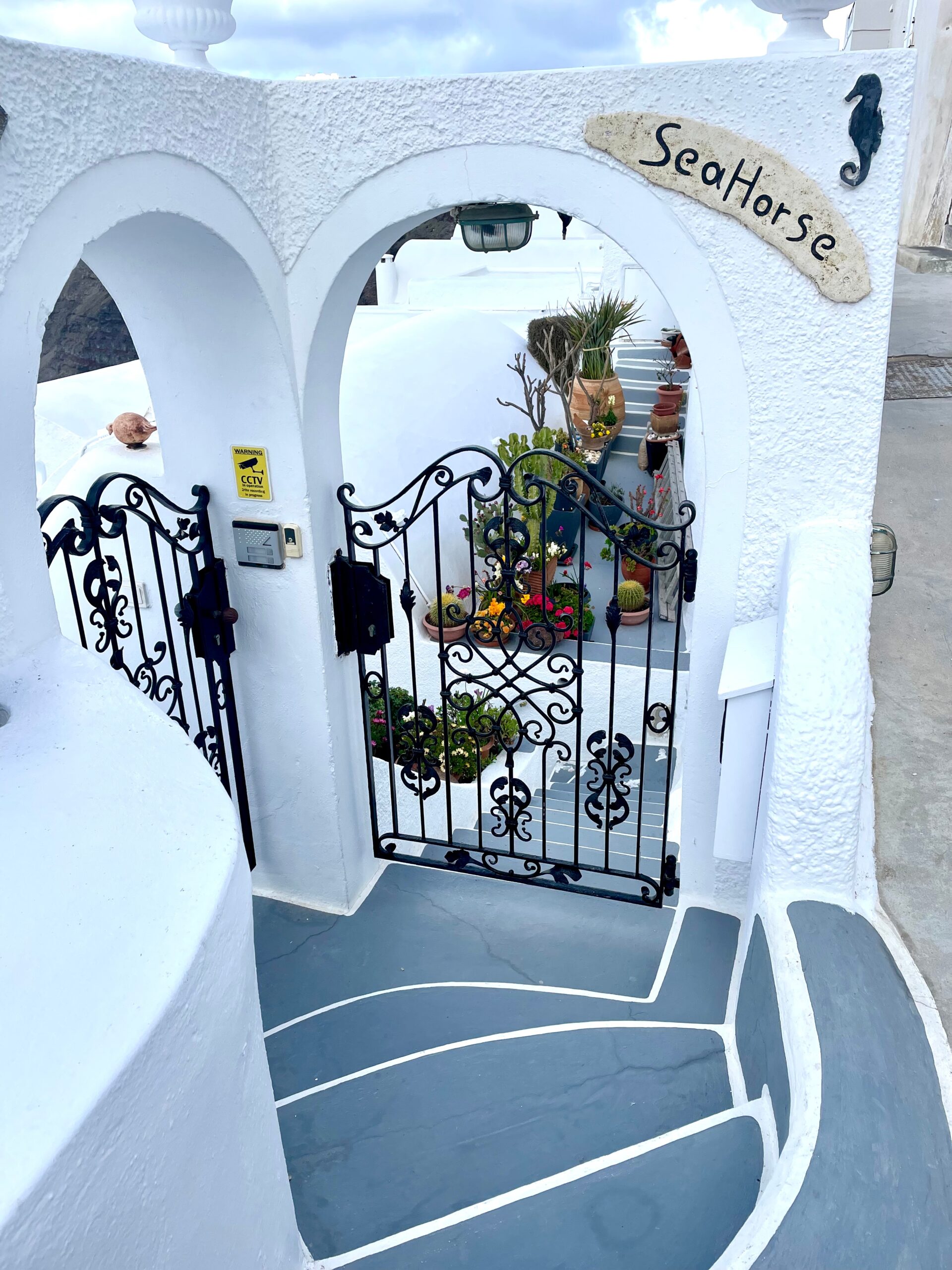
Cute villa below the walking trail
Firostefani runs into upscale Imerovigli. The village is known as the breathtaking “balcony to the Aegean” and is set on the highest point of the caldera rim.
Either follow the trail markers through Imerovigli or choose your own route. At the fork: take a right to go into Imerovigli . . . away from the views (for the bus stop or supplies) or veer left to stay on the scenic lower trail and Skaros Rock.
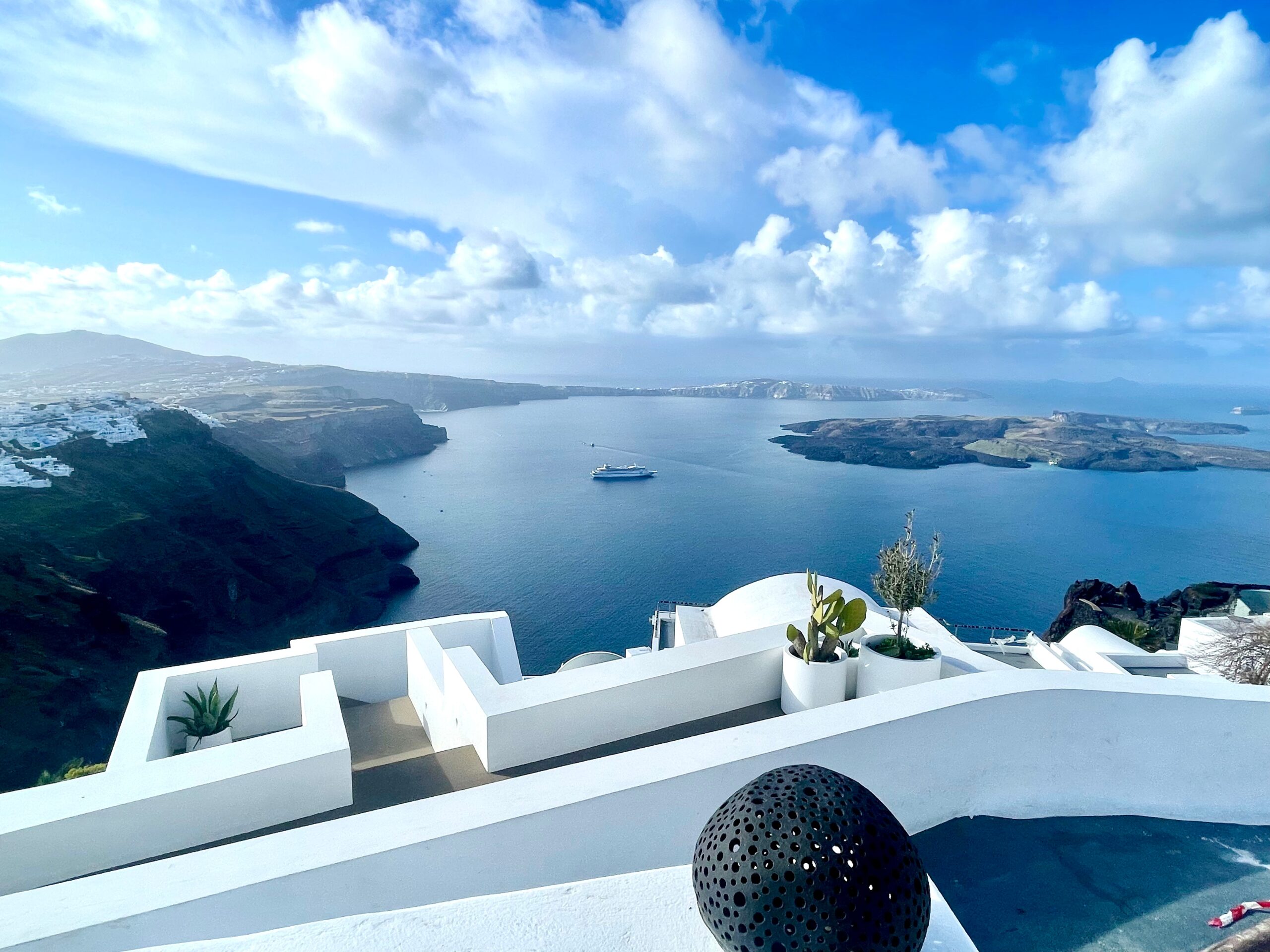
The Imerovigli view from our Airbnb in Santorini: Pure Vida Villa.
With a mixture of whitewashed Cycladic and authentic cave houses, Imerovigli is a traditional, quiet village with fine-dining restaurants, boutique hotels, stunning views and epic sunsets!
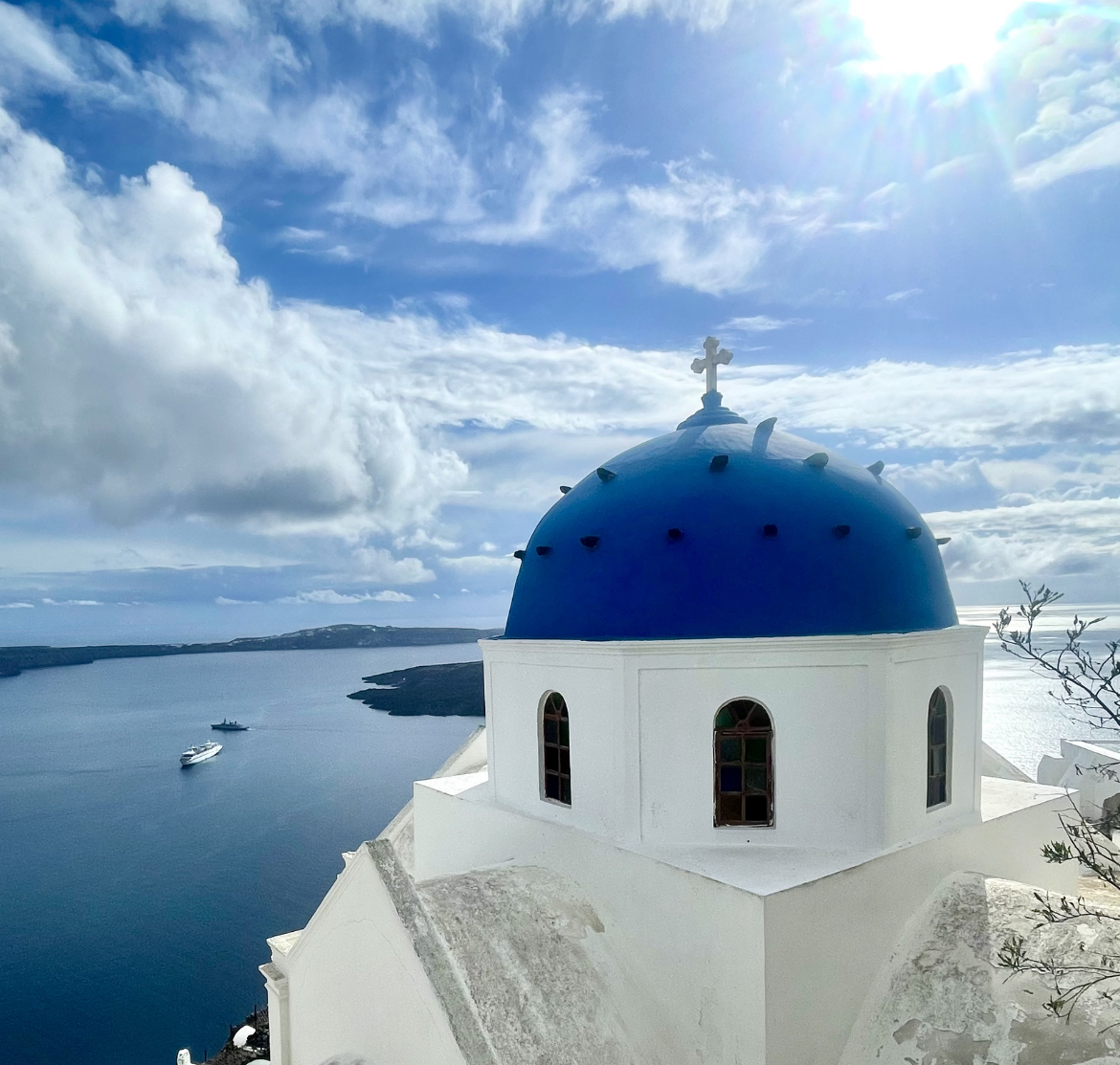
The Church of the Holy Resurrection of the Lord (or Panagia Malteza Church)
This church was built into Imerovigli’s cliffs in the 1800s. Theodoros Borlis, a ship captain from Imerovigli, built the church in honor of a Virgin Mary icon he found floating near Malta.
Up for a challenge? If you detour out to Skaros Rock, it will add another hour or more to the hike. We stayed in Imerovigli and visited separately. The Church of Agios Georgios serves as a marker near the entrance to the Skaros Rock path.
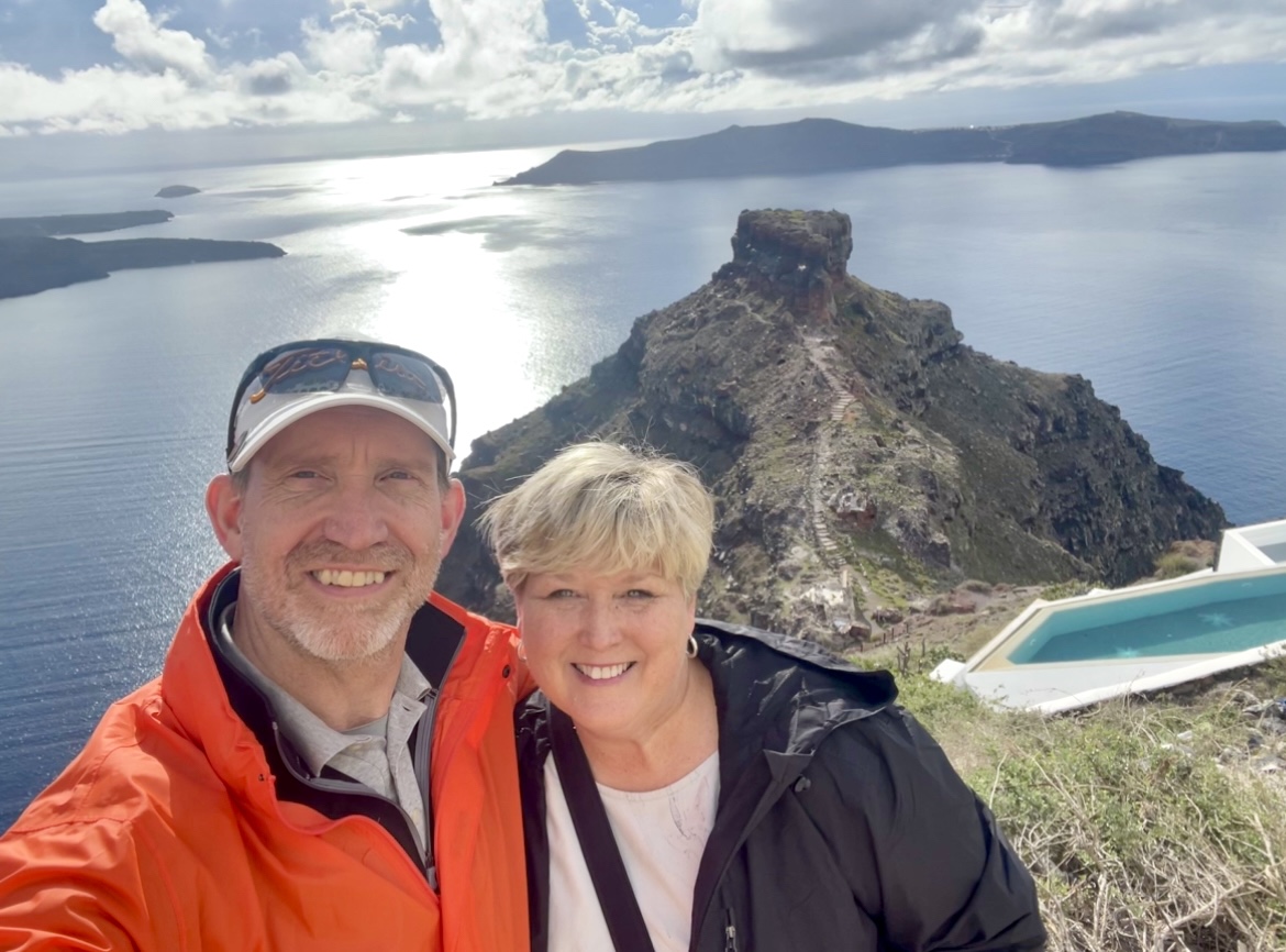
Imerovigli means “watchtower,” and the Skaros Fortress (built by Maarco Sanudo in 1207) was the island’s capital and one of the five fortified settlements built by the Venetians to protect islanders from pirate attacks.
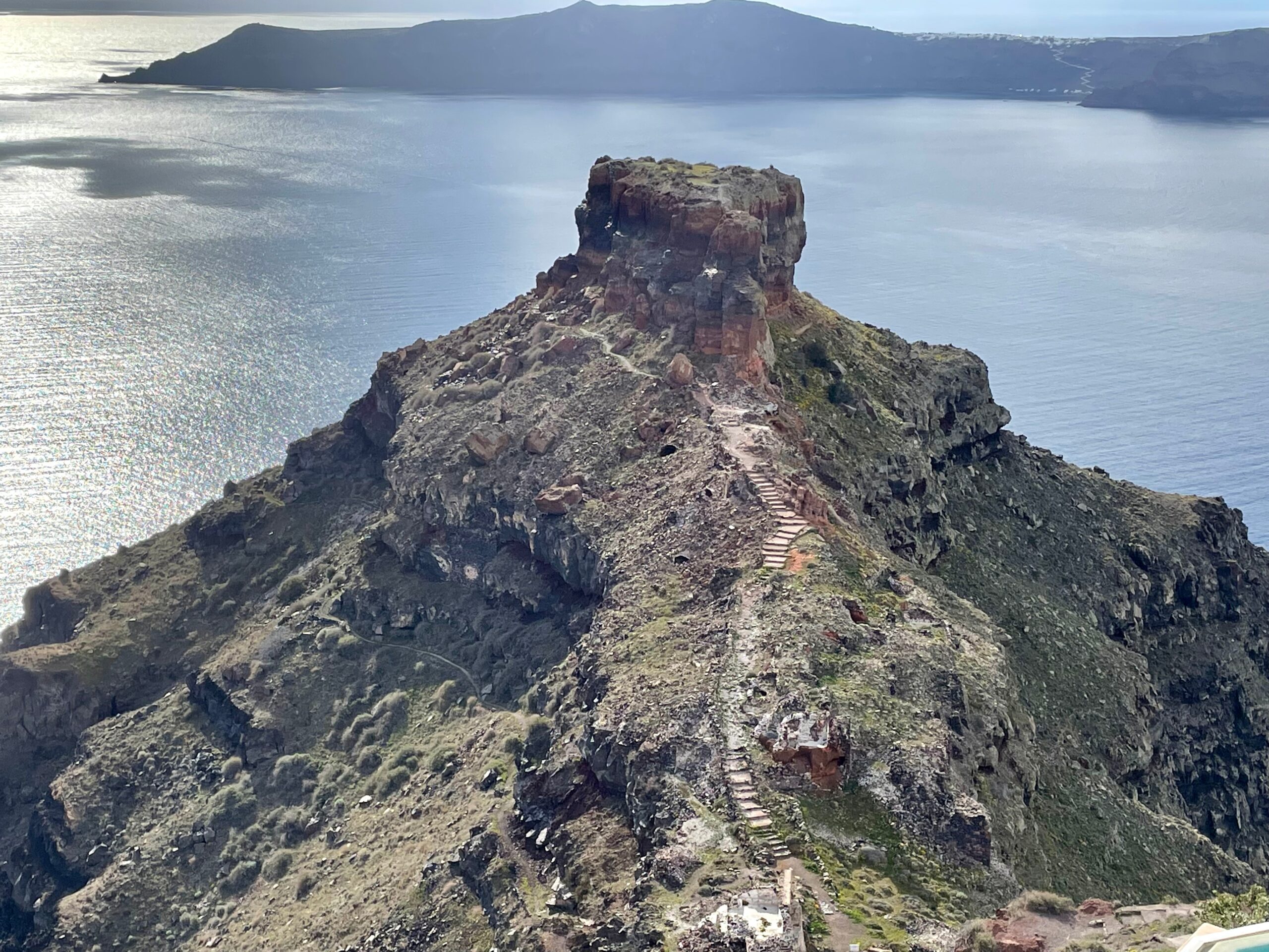
Walk out and climb up a trail of steps for great views on Skaros Rock
Hidden below Skaros Rock at the bottom of the trail is The Chapel of Panagia Theoskepasti overlooking the Aegean Sea. The blue-domed church is dedicated to the Virgin Mary and is free to visit, along with a hidden cave to the right of the trail.
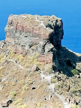
I tried to find a photo with hikers on top of Skaros to give some perspective as to just how BIG the fortress is in reality. It’s farther to hike and climb than it appears!
Look closely: hikers in this photo are on the steps, trail, and on top of Skaros (not my photo).
If you want to climb to the very top (flat portion) of Skaros, some rock climbing experience may be needed.
After it was destroyed by earthquakes and left in ruins, islanders moved to Fira, the new capital.
After passing through Imerovigli, it will begin to feel more like a legit hike with nice views on both sides, fewer buildings, and a rocky dirt path. Several “cliff viewpoint” signs offer photo opportunities.
You’ll come to another fork on the trail before the Church of Prophet Elias. The rocky left fork has the best views, but the right fork is an easier walk for the steady uphill section.
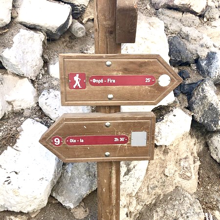
Once you come to the San Antonio Hotel, everyone has to walk along the main road for a short time, but the trail begins again just beyond the Snack Shop.
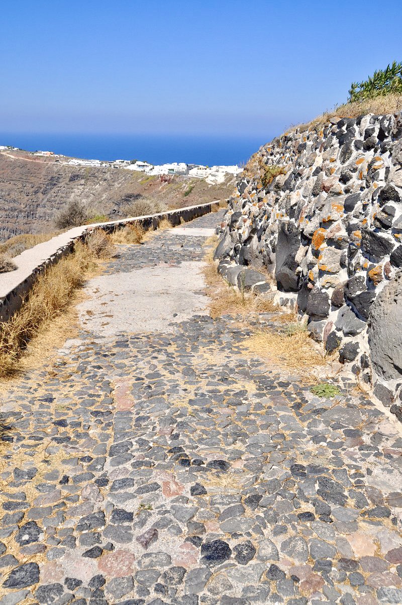
It’s no coincidence the Church of The High Cross (Psilos Stavros) is located at one of the highest points of the trail. Enjoy the gorgeous views as you begin to descend into Oia!
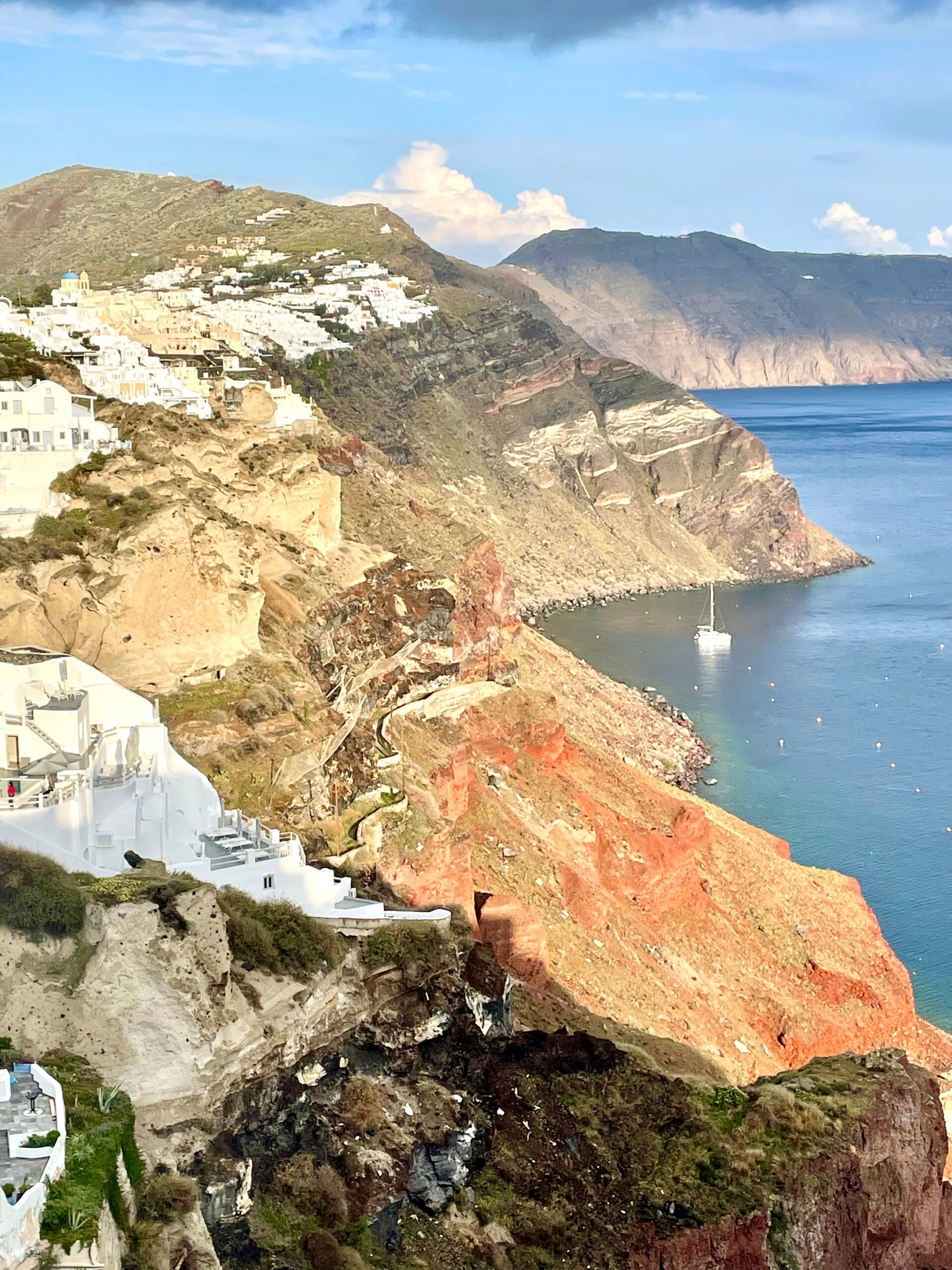
Before you know it, you’ve arrived! Either rest or begin exploring!
Oia is world famous for magical sunsets, ancient windmills, Cycladic cave houses, blue-domed churches, and fresh seafood. Here’s your chance to channel The Sisterhood of the Traveling Pants movies!
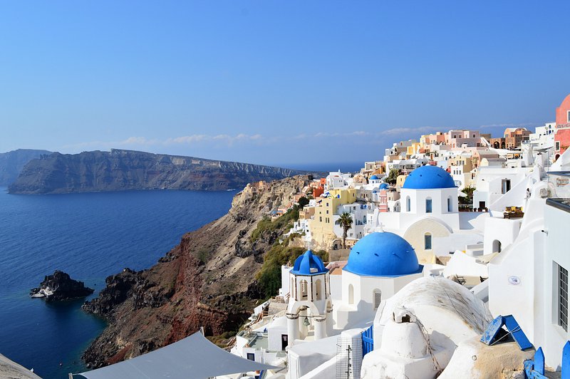
Where to find the famous blue domes in Oia
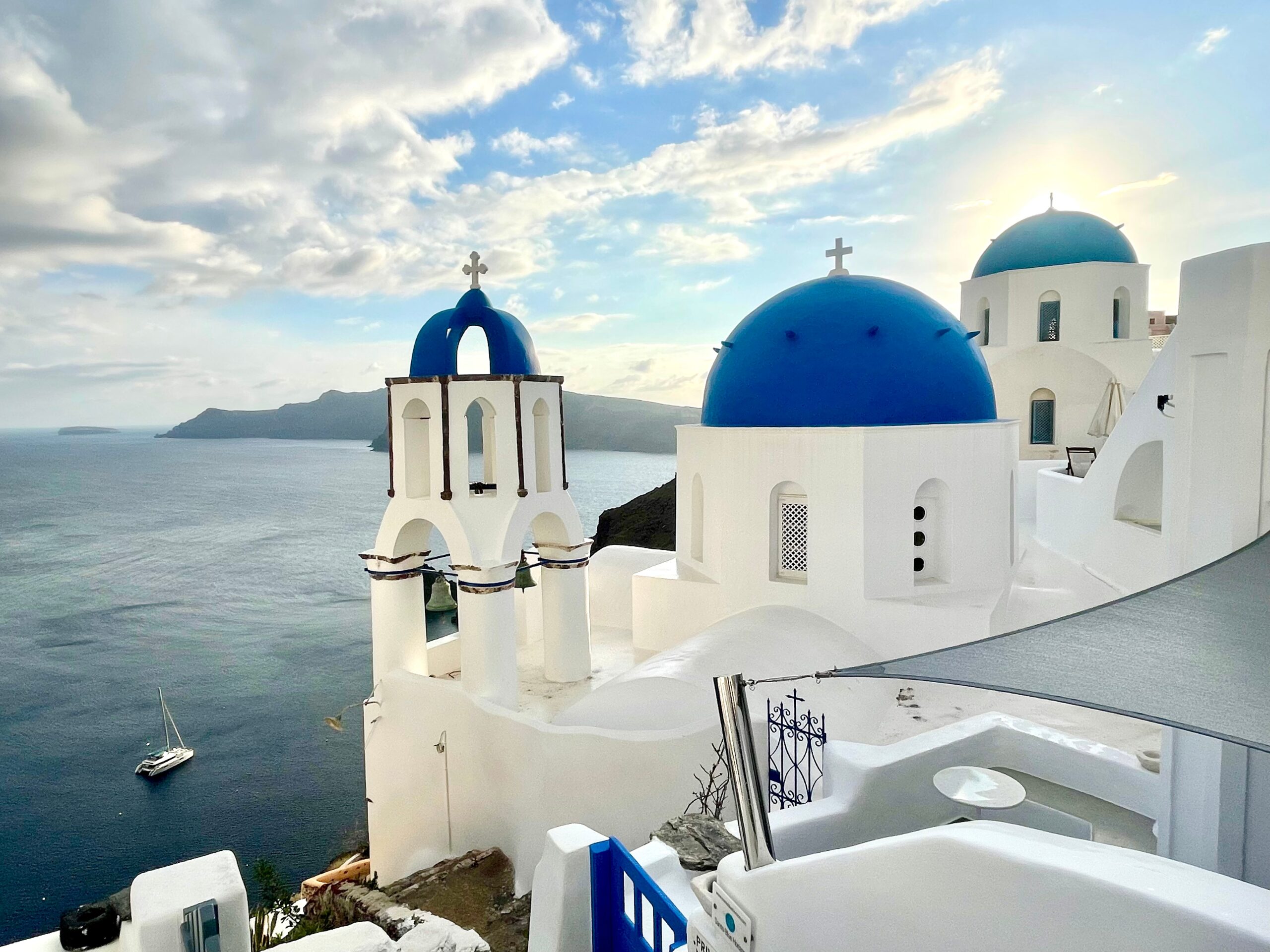
If the massive maze of Oia and its street signage is “all Greek to you,” here’s a step-by-step guide to find the famous blue dome churches:
1. Just off the main walkway (Nik. Nomikou), find Panagia Akathisto Square and the Greek Orthodox Church of Panagia Akathistos Hymn, also called Church of Panagia Platsani (below). The blue-domed church with a 6-piece bell tower was originally housed inside the Castle of Oia, but it was rebuilt here after the earthquake.
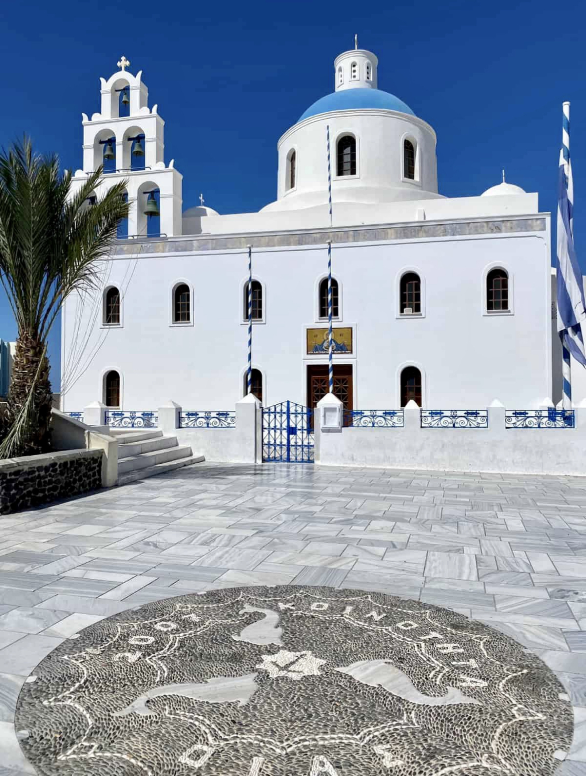
2. With the church behind you and facing the sea, turn right on Nik. Nomikou. Walk about 200 feet and look for the Church of Stavros on your left. (see below)
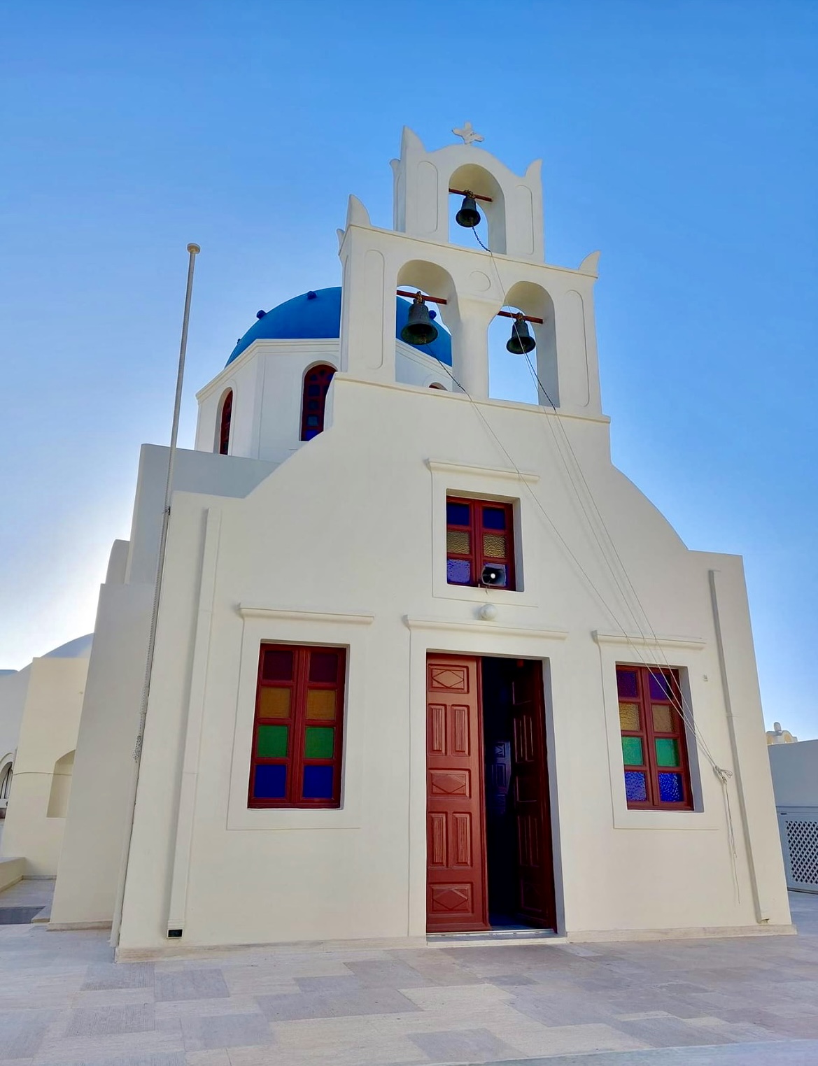
3. Turn left immediately after you pass the church onto a walkway. On your left, the church will now be facing you. Follow that walkway which dead-ends at a private villa door #6020 (shown below).
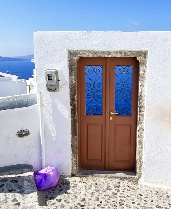
4. From this point you have choices. Walk up to the left or down to the right for pictures of the famous blue domes. We did both; I preferred the view from the right. Good luck!
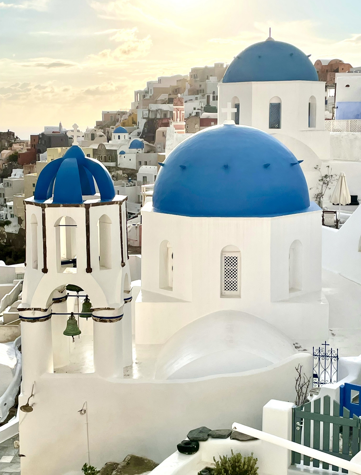
TIP: Please stay on the public walkways (don’t crawl onto buildings, roofs, or enter private gates) and respect both private and church properties when trying to photograph Oia’s sites.
Why are Greek Buildings White and Church Domes Blue?
Two reasons:
In 1938, the ruler of Greece passed a law during a Cholera outbreak for all houses to be whitewashed with limestone (a powerful disinfectant) in an effort to stop disease spread.
Also, during the Regime of the Colonels (1967-74), the military government hoped to uniform the landscape and protect church buildings. Blue and White were the mandated colors for both Cycladic homes and churches (the colors of the Greek flag). It boosted patriotism and national pride. Although regulations have been relaxed, it’s now the trademark of Greece.
Other Santorini tips and facts
Three of our favorite Santorini restaurants:
In the center of Fira, we loved Pelican Kipos Cafe & Wine Restaurant. Whether inside or out, you’ll be immersed in a gorgeous garden of palm trees, flowers and plants as you enjoy delicious food, coffee, and wines from their 400-year-old cave wine cellar. http://pelicankipos.com
In Oia, we tucked in to Thalami Restaurant our first night in town. Passionate about their traditional Greek cuisine and fresh seafood, the owners made everyone feel like family in a restaurant filled with both locals and tourists. Inside or outside seating options with caldera views are available with really, really good food! http://thalamirestaurant.gr
Off the main path in Oia but definitely worth finding, Roka Restaurant is in a 1912 warm and cozy captain’s house with a friendly and helpful staff. We had an authentic Greek 3-course meal, and each dish was not only amazing, but a beautiful work of art! http://roka.gr
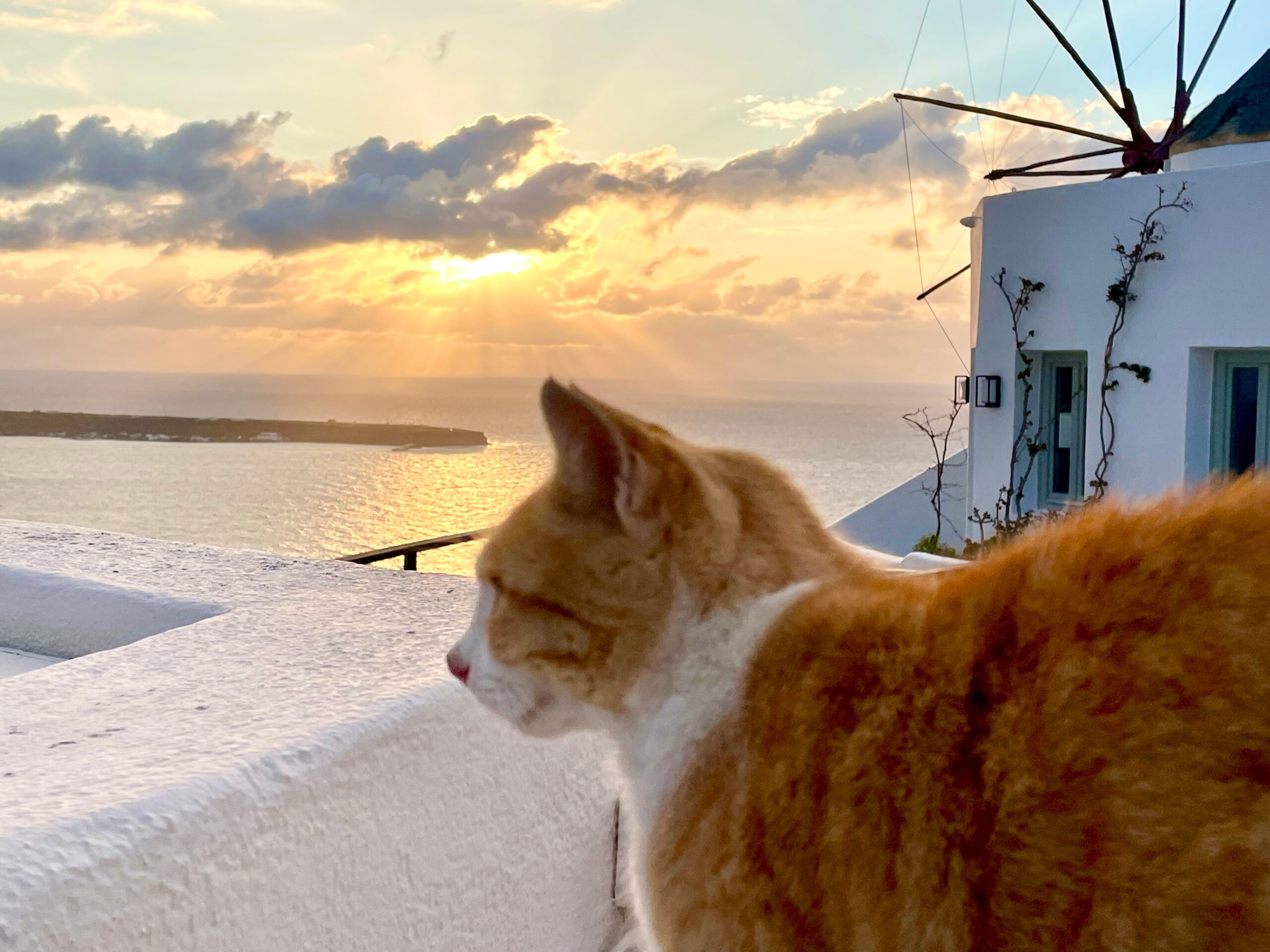
Watch out for kitty cats who photo bomb sunset pics!
Dirty clothes? Drop off all the clothes you can fit into large tub at AD The Laundry Station in Fira. This adorable mother and daughter duo washed, dried, and folded everything for 20€–same day service! Thanks Wendy for the tip! http://laundry-santorini.com
If you rent a car anywhere in Greece, you’ll need to get an International Driver’s Permit (IDP) before you go. We secured our permits at AAA Travel, one of only two private entities in the US authorized by the U.S. Department of State (AATA is the other). With your valid driver’s license and $20, you’ll be driver permit ready in minutes. And don’t forget travel insurance! http://www.aaa.com
Hoping to avoid cruise crowds? Cruisedig.com will tell you not only how many cruise ships will be in (any) port each day but the number of ship passengers, plus arrival and departure dates/times. http://www.cruisedig.com
I hope you’ll get out and explore everything Santorini has to offer. You’re going to love it!
Stay tuned for more of Greece–up next is Athens!
Until then, keep exploring!
Visit my travel blogsite: https://traveltipsbytami.com
Athens, Greece – The Acropolis
Tami Kooch

This is a beautiful island with many interesting sites and landmarks to take in. Getting around is easy by car although you will have to navigate some narrow and rough roads. It is all worth it. However, don’t forget to stop and take a dip in your hot tub and enjoy the sights.
The vineyard vines in the wreath shape is incredible. Thanks for showing that. The colors are breathtaking as well!